|
|
Travelogue -- Dr Bob's Northwest Territory Motorcycle Ride |
|
| Send a message to Dr Bob |
29 May 2015, 11:00 PM ET, Sault Ste Marie, MI
Guess what? Did you look at my byline, or did you just skip right over it? I am still in Sault Ste Marie. I did get in some miles today, though, 7.1 of them. I got more sleep last night than I have for many days, 10 hours. I needed it. I felt much better this morning, ready to tackle whatever the day threw at me. I did a quick glance at weather radar before breakfast, and decided because of weather I could see coming that I would get in maybe 200 miles and then stop for rain. I started munching on my breakfast, and studied the radar a little more closely, and saw how fast the bad weather was moving. That's when I realized I would probably get only 100 miles. I thought about where I would be -- my plan was to ride toward Duluth, more than 400 miles away across the Upper Peninsula -- and decided I didn't want to go into that country and have to find a hotel when it started raining. Plus, I had a real good rate here in Sault Ste Marie at a Best Western. I checked with the desk and they did have a room for me at the same rate, but I would have to change rooms. Not a big deal. I decided to stay.
Then I started thinking about how disappointed my readers would be when I told them I stayed in my room catching up on email and things like that, how boring. And I remembered how I wished a ship had gone through the near lock last night so I could see it better and show you better. So, I headed down to the locks hoping I would see something interesting before the rain hit. And I did.
But let me stick to my first story first. The weather. I could see from radar that there would be two hits during the day. The second hit would be from a cold front that is moving across the country. The first hit would be from a smaller weather system that was leading the cold front. That's the weather that I decided would keep me from going more than 100 miles. Let me show you the radar map from 12:50 PM today.
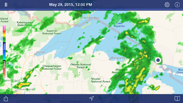
I am the big black dot on the right center. You can see the weather system that was already circling me. It is about 100 miles wide. This is the time that I took my last picture at the locks and hopped on the bike and headed back to the Best Western. That is the weather system that I would have hit after about 100 miles. Just to give you an idea of the map size, you can see Duluth, 400 miles away, just at the westernmost tip of Lake Superior. I may or may not have made it as far as Marquette before running into rain. As I have told you before, I do ride in rain, but I prefer not to if I don't have to. Well, today I did not have to so I stayed where I was. Also in the radar picture just above, you can see the cold front approaching from the west of Duluth. It is worse than it looks on this map, it runs far to the north and to the south.
Here's another radar picture, from a couple of hours ago.
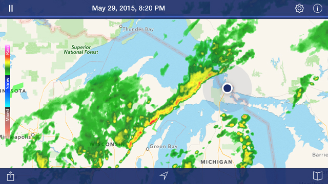
The weather system you saw over me in the 12:50 PM radar picture has disappeared off the right side of the radar, and the front is now approaching us here in Sault Ste Marie. My hope is that the front has completely passed over by morning. It will be sunny all day after it does pass. I expect it to be colder tomorrow also, I will probably be riding with temperatures in the 40s.
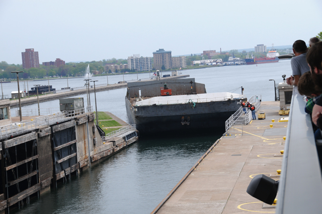
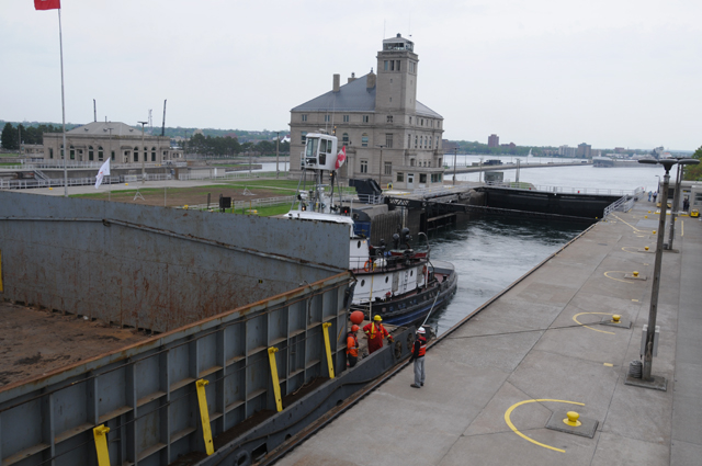
Enough with the weather. Let's talk about the locks. Here's the boat we will be following through the lock. The first thing you should notice is that it is as wide as the lock, it just barely fit. It is a barge with a tugboat pushing it. At the moment all you can see is the barge. It is coming out of Lake Huron into Lake Superior, which is 21 feet higher.
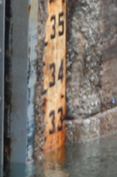
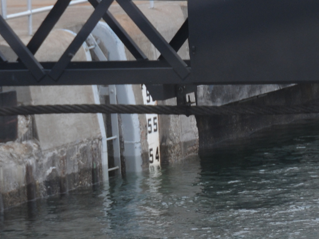
Here's the water depth, you can see it is a little lower than 33 feet, maybe 32.5 feet. The numbers may be hard to read, the top number is 56 feet and the bottom number is 33 feet.
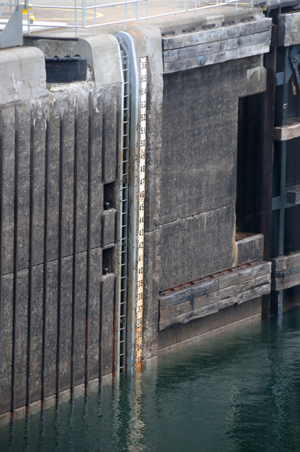
Here's a closer view at the water level.
Slowly, ever so slowly, the tugboat pushed the barge into the lock. You could hear scraping sounds much of the time.
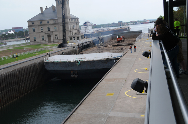
Finally they are in position, and the gates are closing on the Lake Huron side. You can see the top of the tugboat here. Also note how low the barge is sitting in the lock. The top of the sides are just about the same height as the dock.
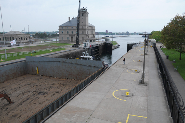
The gates are almost closed now, time to start raising the water level.
Pumps are not used to raise the water level, they just let water flow in from the high side. And out to the low side when going the other direction.
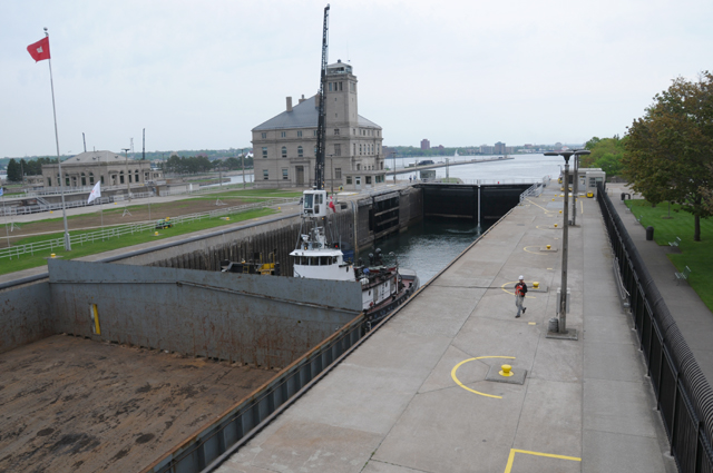
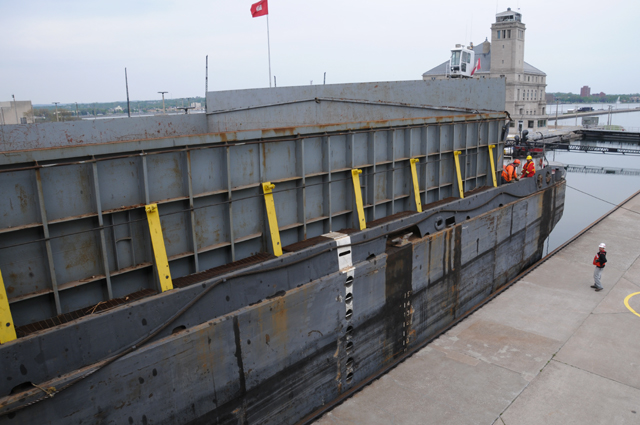
Six minutes later the barge has risen considerably. See how the men on the barge are at the same height as the man on the dock. All those yellow things are showing, they were hidden in the picture six minutes earlier.
Look how much higher the men on the barge are now. They are well above the man on the dock. Look how high those yellow things are. Look how high the sides of the barge are, they were at dock level before. This is 38 minutes after the Lake Huron gates closed.
Now the water level is almost 54 feet, maybe 53.5 feet, 21 feet higher than it was 38 minutes ago.
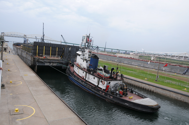
All done, they are moving into Lake Superior.
|
|
|