|
|
Travelogue -- Dr Bob's Northwest Territory Motorcycle Ride |
|
| Send a message to Dr Bob |
3 June 2015, 10:30 PM CT, Columbus NE
I got an email from Phil (winner of one of the chocolate shakes) asking for more details on what went wrong with the bike yesterday. He wanted to check his bike before setting off on a long trip in the near future. Yesterday I thought about giving more details, but didn't, so I will do so now.
Nothing actually was broken. The spline on the transmission link side of the shifter shaft was worn enough that the short vertical link slipped off, no doubt due to a combination of usage and vibration. I was able to put it back together, but it was very loose and I did not trust it to stay together. Normally if you take the toe/heel levers and try to push them toward and away from the bike, there is no movement. Mine, after I put it back together, was moving about half an inch. What I don't know is whether or not it was loose like that before it came apart. Todd, at Glacial Lakes Harley, told me this was not uncommon.
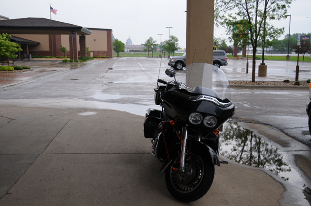
Here's my first picture of the day, outside the motel.
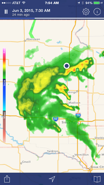
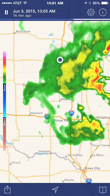
As you can see, today was a rain day, at least for the first few hours. I checked radar early, and then again before setting off. The picture on the left was a radar image at 7:30 AM Eastern Time, the picture on the right was at 10:05 AM Eastern Time. I was in Watertown SD, so the time there was an hour earlier. My first look was when I got up. My plan was to ride south. But you can see that it was wet and would get wetter since the weather system was moving to the east. So, I decided to ride west then south. You see the road going south at the western edge of the rain, the road that runs through Aberdeen, I figured that by the time I got going, that road would be clear, and the road going west would be clear.
About 2 1/2 hours later, I had left the motel in light rain and was having an Egg McMuffin and hot Latte at a McDonalds before heading out to the west. I talked with a guy whose name was Jerry wearing a Can-Am Spyder T-shirt, told him I planned to head west because of the rain that was going on as we spoke, and he told me that I should not do that. He said there is construction on the road going west, and the road is very bad, not at all suitable for a motorcycle. He rides a motorcycle himself, and lives in Watertown, so I figured he knew what he was talking about. He was suggesting going a little north first, then west, then south to that road beyond the construction.
Now you should look at the radar map on the right above. This was about the time we were talking. I decided to simply go south on I-29 instead, and ride through the rain. It didn't look that bad, mostly green with some yellow, and no red, the bad stuff.
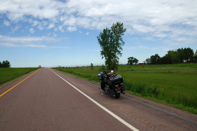
So that's what I did. I was in light rain the first 30 miles, sprinkling rain the next 10 miles, then no rain for 20 miles, then spritzing rain for 10-20 miles. Then all clear. What I call spritzing rain is less than sprinkles, little specks hit the windshield and roll up and over my head. I went west on I-90 when I got there. Here's what it looked like at that time. The rest of the day was just as gorgeous as this.
I decided to do something corny today. My brother Larry had suggested this to me two years ago, but it would have been a couple of hundred miles out of my way, but this time it was only about 70 miles out of my way.
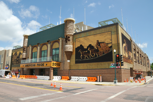
This is the Corn Palace in Mitchell, South Dakota. They say it is the only one in the world. Those pictures are made of corn cobs.
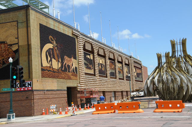
Here's a better view of the side.
Here's one of the pictures.
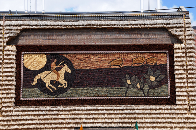
And here's a close up view of one of the pictures.

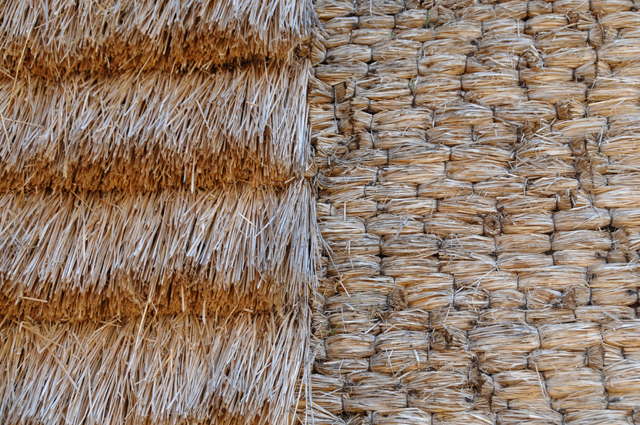
And a close up view of the area outside of that picture.
A lot of construction was going on, you can see that in the first two pictures.
I rode from Watertown to the Corn Palace on Interstates, because of the rain, but rode regular highways the rest of the day. I picked up a total of 368.8 miles today, more than half on regular highways.
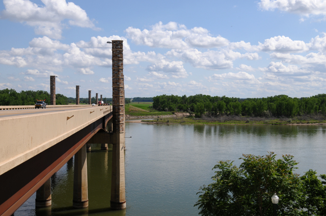
I crossed the Missouri River today. Here's the motorcycle bridge.
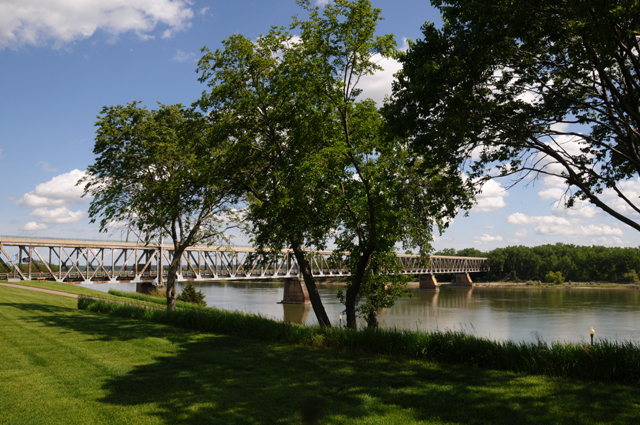
And here's the railroad bridge.
I have taken other pictues of the Missouri in times past, here's one from two years ago that I took in Montana, 1,000 miles away.
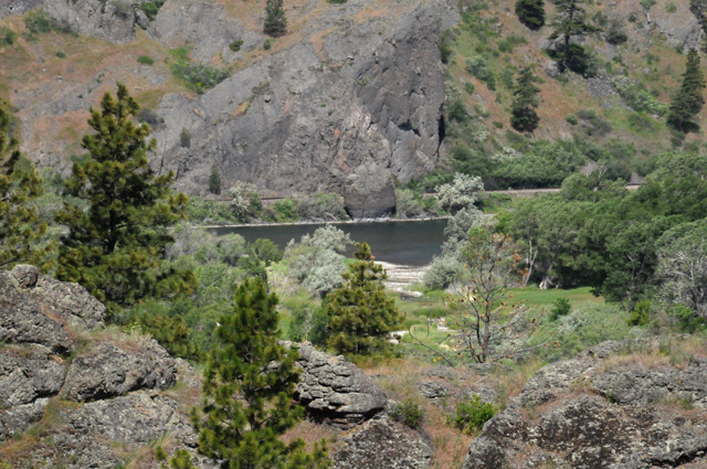
The Missouri is a big, long river, the longest in the United States, 2,341 miles altogether. The Mississippi is only 2,202 miles long.
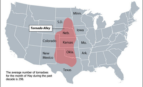
Have you noticed that I am riding right down Tornado Alley? Last night there was a tornado watch north of me, tonight there is one south of me. Hopefully it will stay that way, not where I am.
I hope to have another Capitol for you tomorrow. See you then.
|
|
|