|
|
Travelogue -- Dr Bob's US50 Motorcycle Ride |
|
| Send a message to Dr Bob |
19 May 2012, 10:40 PM PT, Buttonwillow, CA
So here I am in Buttonwillow. Buttonwillow? Where is that? In the San Joaquin Valley, near Bakersfield. Why, one might ask, is he in Buttonwillow? Because that's where he was when it was late enough to stop for the night. Turns out that it may have been fortunate, though. I have been planning on taking the southern route home, I-10. Tomorrow the temperature in Phoenix, which is on I-10, is expected to be 104°F. Tucson 100°, and 106° on Monday. Now that's warm. The northern route is I-40. Barstow is expected to be 99°. Needles 108°. Flagstaff 79°. And Albuquerque 84° on Monday. I am not sure, but the southern route should be super hot all the way over the next two days while the northern route will be hot in some places and cool in others. Maybe I will decide when I leave tomorrow morning.
I started the day in Sacramento, the capitol city of California. This is the fourth state capitol city on US50. Here's the Capitol of California.
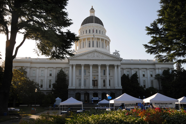
I would prefer to not have those tents in the picture. Here's another from the front quarter.
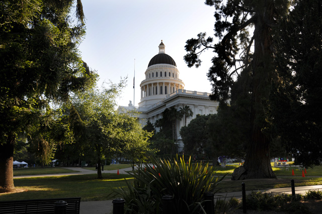
You don't have the front view, but you don't have the tents either.
I rode 443 miles today. I have 5,250 since leaving North Palm Beach. I reached the end of historic US50, the intersection of Harrison and 10th, or so I have read. It wasn't a very glamorous spot. I saw no signs showing that US50 used to be here. I rode the old route, from Sacramento through Stockton and Livermore to Oakland, then across the Bay Bridge into San Francisco.
Historic US50 runs through Livermore, as I said. You may recall that I mentioned Livermore on the Introduction page. I was in Livermore around New Years Day in 1964. I was a Senior at Purdue, and I had an interview with Lawrence Radiation Laboratory in Livermore. They offered me a job at $5 more per month than RCA Laboratories had offered. The RCA salary offer was $655 per month. Not a lot, was it. But in those days it wasn't bad. I decided to find the Lawrence Radiation Laboratory when I passed through Livermore. First, you have to note a name change, since 1971 it has been called Lawrence Livermore National Laboratory. A more public sensitive name, I suppose. It does secret types of work, so all I could see was a fence with buildings way back from the fence. It didn't seem to be a good picture for my travelogue. But, there is a hill just down the road. I rode the bike past the hill, turned around, and parked on the hill to get this shot.
It is a one square mile campus, I have read. I remember very little from my interview day, but I do remember it was an extremely pretty campus. I spent part of the day wondering what my career would have been like if I had taken that job. The primary reason I selected RCA was that my Masters Degree would be fully supported by RCA, including full salary and the school costs, and I would have about a 50% chance of getting a PhD with RCA paying the school cost and paying me half salary whenever I was a full time student, and the thesis could be done with full pay at RCA. At Lawrence, I would have been on a tuition refund program at the University of California (which founded the Laboratory) and getting a PhD would be extremely questionable, certainly for "free". I don't regret my decision.
After arriving in San Francisco, I rode around the city and captured a picture of the Bay Bridge.
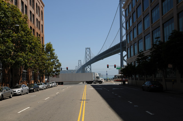
Not one of my better photographic endeavors. I didn't notice that truck until I started working on the pictures on the computer. I was standing in the middle of the street to get the picture and hustled back to the side, and never even realized that the 18-wheeler flashed into the scene and wiped out half the bridge. The little picture on the camera showed that the exposure was good, but I never spotted the truck. Had I done so, I would have taken another picture. Maybe I should not have included this picture so that you would not know that I messed up a picture.
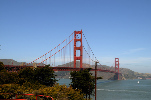
I continued riding up the Embarcadero. Past Fisherman's Wharf. And as far as it went, then on to the Golden Gate Bridge.
Then I continued riding to the Pacific Ocean.
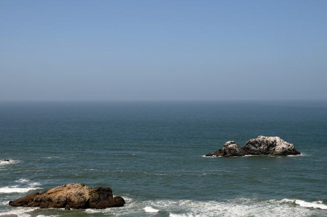
Once I reached the Pacific there was nowhere else to go, I had finished US50, I had reached the ocean, maybe it was time to turn around and head home. So I did.
I set the GPS to take me home. It said I would arrive at 6:00 PM. It didn't say what day.
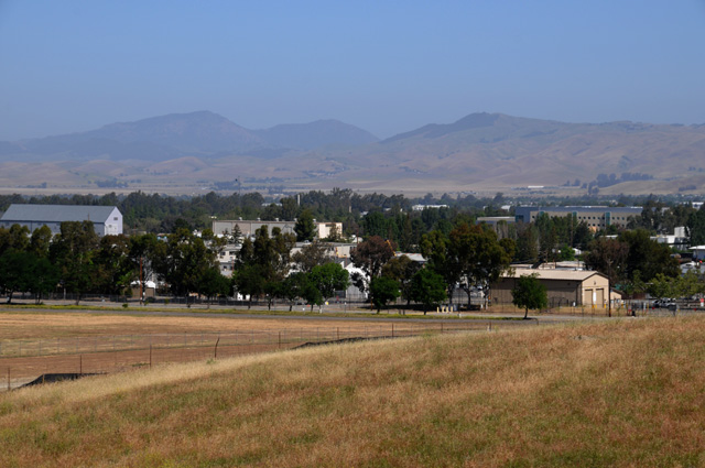
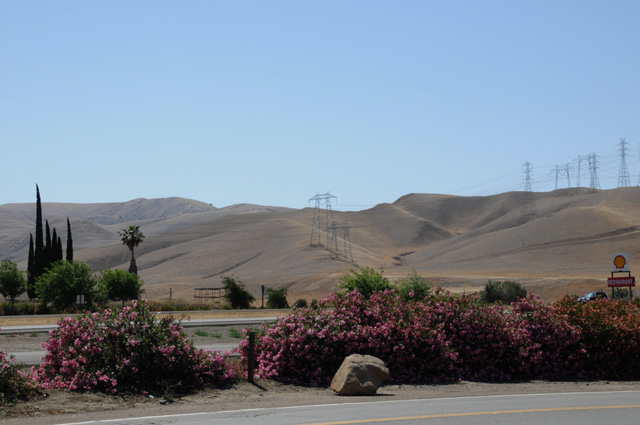
I took a picture to show the landscape in the area just south of San Francisco on I-5.
Then a bit further south, there was a "Vista" where I could get a good picture of the California Aqueduct looking to the west.
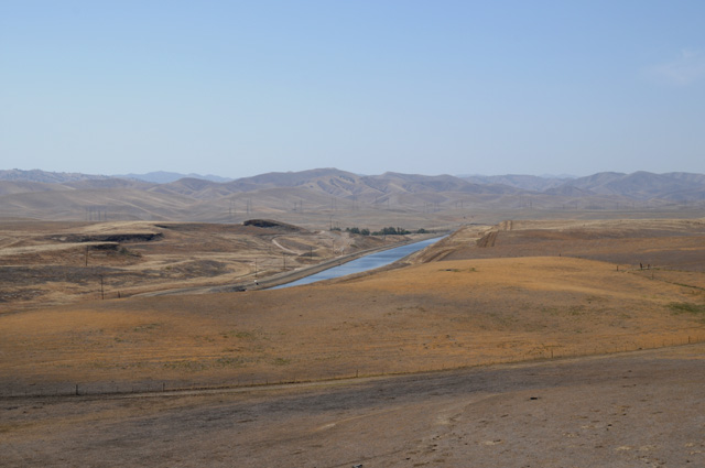
And by turning and looking east I got a picture of the farmland in the San Joaquin Valley.
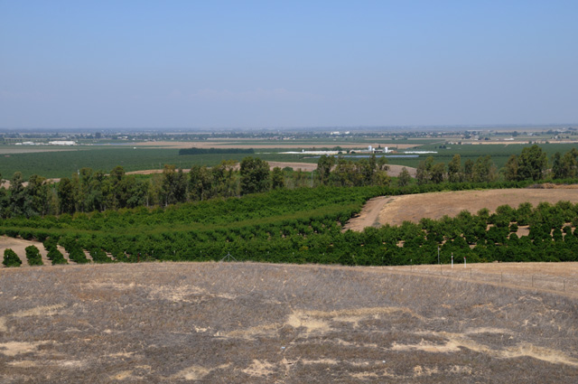
Without the water from the aqueduct, the farmland would not be green.
Come back and join me tomorrow to find out which route I am taking to Texas. I probably will not have as many pictures as I have had along US50, but I will try to get a few each day.
|
|
|