|
|
Travelogue -- Dr Bob's US50 Motorcycle Ride |
|
| Send a message to Dr Bob |
21 May 2012, 11:00 PM MT, Albuquerque, NM
Must tell you the big news of the day first. I saw a tornado.
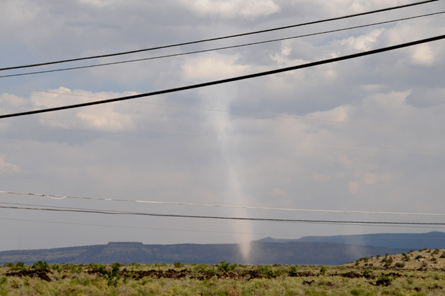
By the time I got this picture, it was almost gone. I was in Grants, New Mexico. I had just gotten gas and was headed back to I-40. As I was crossing over I-40 I noticed a big dirt devil in front of me to the right. Then I noticed the funnel cloud going all the way to the ground in front of me to the left. As quickly as I could, I got off the bridge crossing I-40 and onto the I-40 entry ramp, and stopped the bike on the shoulder of the ramp, and grabbed my camera. I got four pictures, this one was the first and the best. Another car stopped right in front of me, guys jumped out with cameras and they were taking pictues also. One of the guys walked over to me and said they had seen it for ten miles and it was bigger when they first saw it. I said are you sure it was a tornado, and he said I am from Missouri and I know tornados. He told me that severe thunderstorms had been forecast. This wasn't even a thunderstorm, just a cloud.You can see some blue sky in the picture. Notice a second circulation to the right. For a moment it looked like it was going to get bigger, then it disappeared. When I first saw the tornado it was about equal thickness all the way from the clouds to the ground. You can see it has thinned in the middle in the picture.
Back to more mundane matters. I rode 380 miles today. I had wanted more, but it was not possible. I was tied up early in the day and got off to a later than normal start, plus I lost an hour today going from Pacific time to Mountain time. I expect to lose another hour tomorrow going into Central time. I have ridden more than 6,000 miles since leaving home. I expect I will have more than 8,000 by the time I get home. And I have had a chocolate shake each day to keep my energy level up.
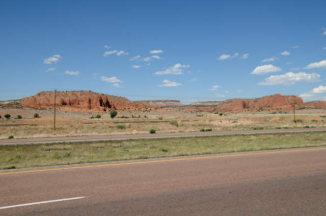
Here's some more red rocks. I can't have enough of them. This is in New Mexico before reaching Grants.
Not long after that I reached the Continental Divide.
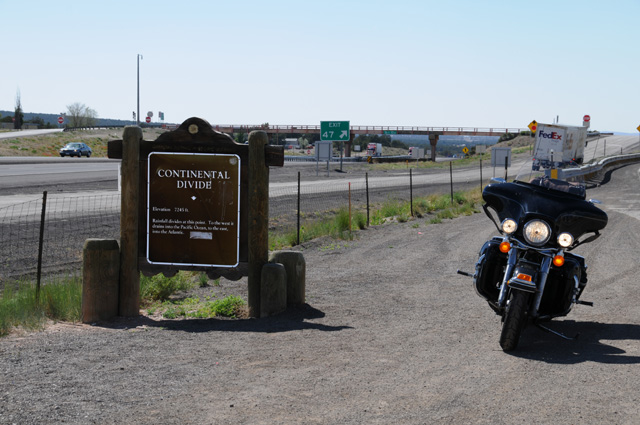
Here's what the sign says: Elevation 7245 ft. Rainfall divides at this point. To the west it drains into the Pacific Ocean, to the east, it drains into the Atlantic.
So tell me now, is it downhill the rest of the way home, can I just coast back home?
About half an hour later is when I got gas. While at the gas station, this train pulled up behind the station and waited for me to get a picture before heading out. That was nice of the engineer. There are five engines on the front. These trains out here are long, and they go past every few minutes, both ways. The gas station was on Route 66. Train tracks always seem to be next to Route 66.
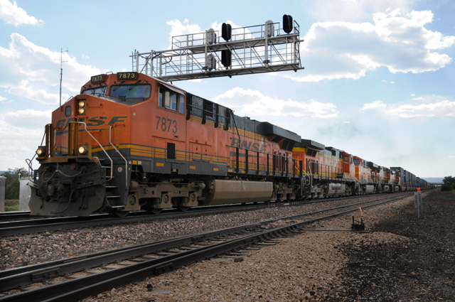
Look at the sky. The tornado picture was taken exactly ten minutes later and less than a mile from this point. You can see a bridge going over the train on the right just as the train is disappearing. That's how far away I was when I also crossed I-40 which is just on the other side of the train tracks.
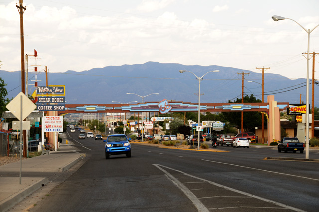
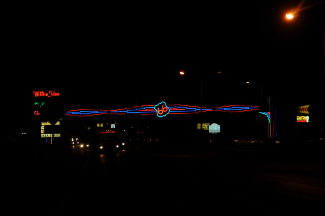
Now for my last pictures of the day. When I did the Route 66 Ride four years ago, riding out of Albuquerque I passed under a Route 66 sign that I later wished I had photographed. I did not because I passed it too quickly and didn't want to turn back. Plus I really would have wanted it at night. Well, today I got it in daylight and after dark.
Tomorrow I will decide when to turn southeast. It depends on the temperature (the longer I stay north the less hot the ride will be) and on the weather (the northern route is more likely to have thunderstorms and tornados). I will look at the forecast tomorrow morning and decide. The earliest I would go south is at Santa Rosa, about 100 miles ahead. The latest is Oklahome City, about 500 miles ahead.
|
|
|