|
|
Travelogue -- Dr Bob's Wrap-Up Motorcycle Ride |
|
| Send a message to Dr Bob |
22 May 2018, 10:30 PM CT, Clarksville, TN
I left Warrenton this morning with the idea that I would go to a park where the Missouri and the Mississippi come together. I set it up on my GPS and took off, with a brief stop for an Egg McMuffin and hot Latte. I followed the roads faithfully, it was a longer distance than I had anticipated. Then I got to the last turn off, only 4.5 more miles to the confluence point, and guess what. The final 4.5 miles was a dirt/gravel road. You know what that means. It is as bad as the plague. So, not wanting the plague I turned around. I crossed the Mississippi, I had already crossed the Missouri twice this morning, and tried riding down a road that runs along the river, heading to a point where I could see both rivers at the same time. Well, it was not to be, the road is not close enough and no roads run to the river side. Then I came to a tall tower, the Lewis and Clark Conference Tower. It was quite tall, I was sure I could see the confluence from the top of the tower. I did notice that my bike was the only vehicle in the parking lot. That did not bother me, though. I marched right up to the tower and found everything was locked. Turns out it is closed on Tuesday. So I spent a lot of time and miles chasing the impossible dream.
I rode 357 miles today. I have another 882 miles to get to North Palm Beach. How can that be? Last night I had 1,199 miles to North Palm Beach. Isn't 1,199 minus 357 equal to 842 not 882? I guess that means I used up 40 miles chasing the impossible dream. Well, that's what I do a lot, side trips. This was just another one. Most of the time they work out.
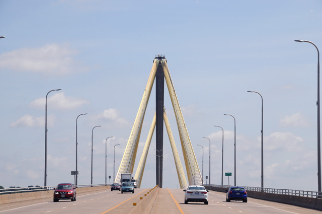
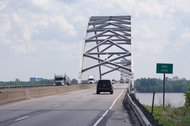
Let's see what pictures I have for you today. Here's the bridge I used to cross the Mississippi. It is US-67, and it is called the Clark Bridge.
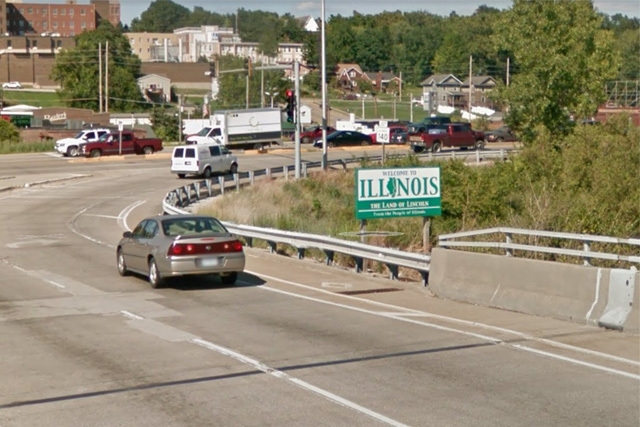
You notice that I was able to stop on the bridge. I was not able to stop on the other end of the bridge, so I do not have a picture of the "Welcome to Illinois, the Land of Lincoln" sign for you. But I was able to steal it from Google Maps Street View.
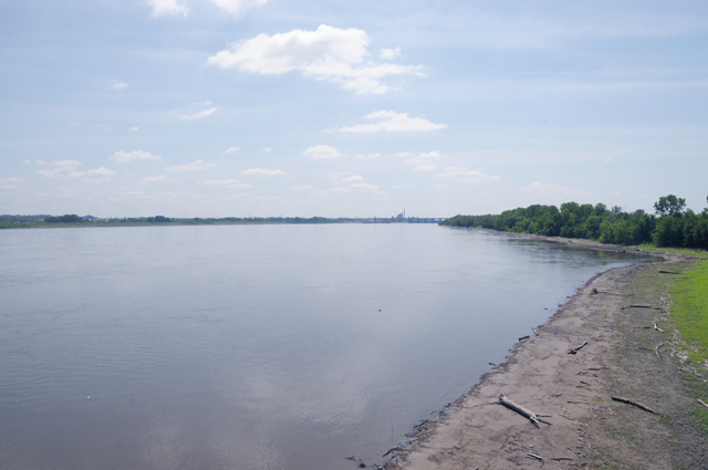
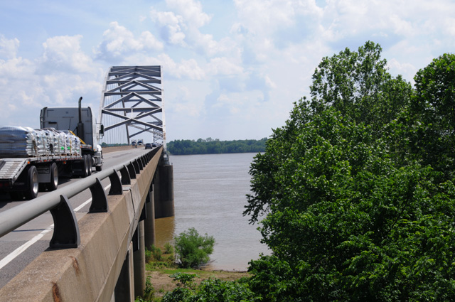
Back on the Clark Bridge, this is the Mississippi River looking south toward St. Louis.
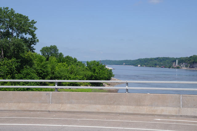
And the Mississippi River looking north. These two pictures were taken from the same location on the bridge as the picture of the bridge.
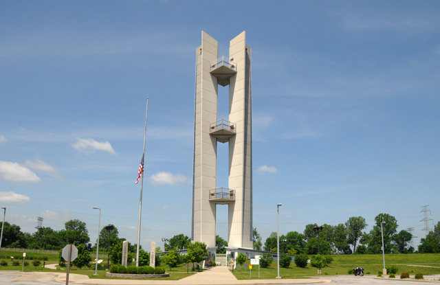
And here is the Lewis and Clark Memorial, the tall tower that was closed when I most needed it. That was what finally crushed my dream, the impossible dream. By the way, have you ever heard Gomer Pyle (aka Jim Nabors) sing "The Impossible Dream"? You can see my lonely bike on the right.
I kept riding along, and crossed the Ohio River. I stopped short of the bridge, you can see it has a narrow shoulder.
I walked beside the edge of the bridge to try to get a good picture of the river, but it was not to be. Here's the best I could do. There is a sharp drop just in front of me, that ground you see is many feet below me. No way would I try going down there.
Finally, I am in Kentucky. The birthplace of Abraham Lincoln. See it on the sign?
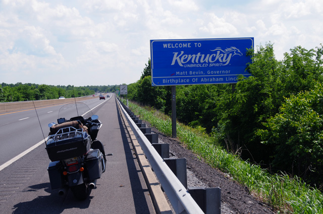
Kentucky is also the birthplace of Robert Hopkins. When are they going to put my name on the sign?
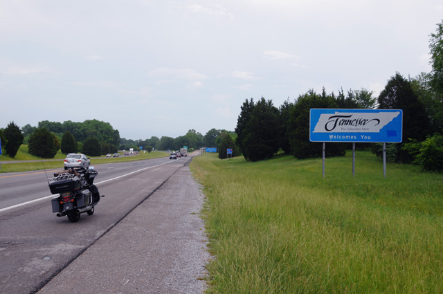
Riding right along I reach Tennessee.
Did you notice that it is completely overcast now? I can see storm clouds ahead. And just up ahead is the Kentucky Welcome Center, you can see the blue sign up the road. It is not readable, but trust me, it is the Kentucky Welcome Center. Which I entered. I wanted to check my NOAA Weather Radar app. Here's what I saw.
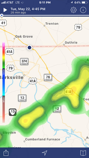
The black dot is me, right on the Kentucky and Tennessee border. Down the road a few miles is a line of thunderstorms. Just disappearing off the left side of the picture is the town called Clarksville. The "C" is missing on the radar screen. Well, that's where I am right now. I stopped about four miles later to lay down my weary head for the night with visions of the impossible dream.
|
|
|