|
|
Travelogue -- Dr Bob's Route 66 Motorcycle Ride |
|
| Send a message to Dr Bob |
25 May 08, 11:00 PM, PDT, Glendale, CA
Some statistics for you. I have ridden more than 5,000 miles since leaving North Palm Beach. I have taken more than 600 pictures. Wow! That's an average of more than 1 picture every 10 miles! I didn't think I was stopping that often.
Today I repeated some of the rides I loved so much when I lived here. I rode the Angeles Crest Highway. I rode Mulholland Highway (different from Mulholland Drive). I rode the Pacific Coast Highway.
Let's start at the beginning. As I have found in about 80-90% of the hotels I have stayed in, this one had Internet access problems. Everything was fine till 8:30 this morning when their wireless suddenly quit working. I spoke to the lady at the desk. Then after breakfast I spoke with the manager. He said he would call AT&T. I knew AT&T was not the fault. Sometime later I spoke with the manager again, and he said that AT&T said everything was OK. I told him I knew that, the problem was within his hotel. We tried rebooting the router and the wireless, but that did not fix the problem. So, to get Internet access now, I have to go the hotel office and plug in an Ethernet cable. It could be worse.
When I headed out, about 9:00 AM, the sky over the San Gabriel Mountains looked forbidding. I decided to see how far I could go without turning around. I made it all the way to the top of Mt. Wilson. That's where the TV antennas are located in Los Angeles. That's also where the historic Mt. Wilson observatory is located. When I first arrived at the top, I could see downtown LA. Just a few minutes later, downtown LA disappeared. I went to the observatory and came back to the bike to find that the bike was starting to disappear in the clouds. I hustled down Mt. Wilson and proceeded along Angeles Crest to Newcombs Ranch and had lunch. Let me stop here and give you some pictures.
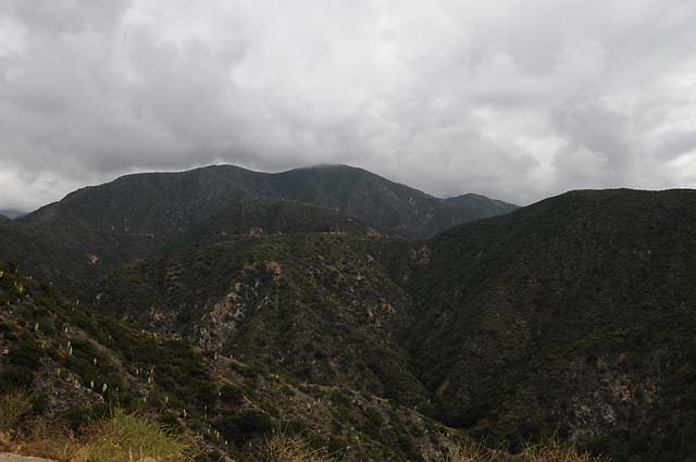
I have just started up the mountain. You can see the tall buildings of downtown LA in the middle. In the second picture you can see the clouds just touching the mountain tops, but that's not the highest mountain!
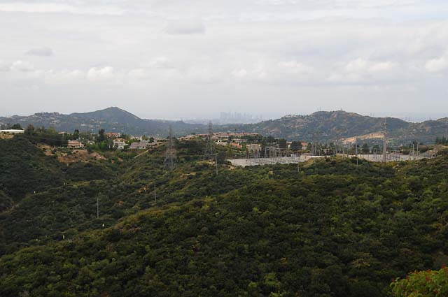
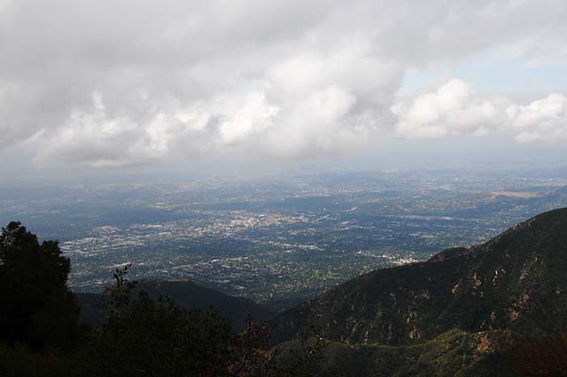
I kept going. This shot of downtown LA is from about 3,000 feet. You can see the road running up the side of the mountain.
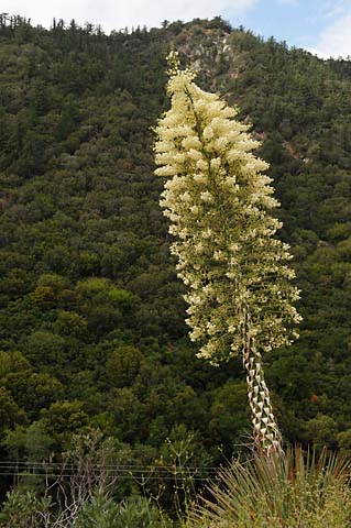
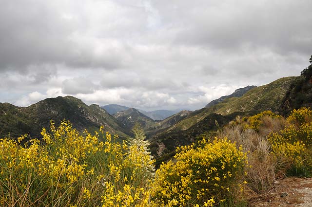
These plants were all over the sides of the mountains. This one is about 12 feet tall.
I like this picture, with all the pretty flowers.
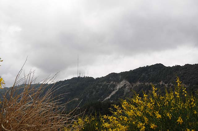
Ths picture is looking up at Mt. Wilson. See the antennas? And the road going up the side of the mountain? You will see a similar picture later, and the antennas will have disappeared in the clouds.
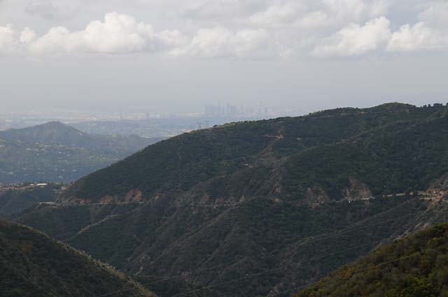
This is from the top of Mt. Wilson, almost 6,000 feet high. I could see downtown LA with the naked eye, but it really doesn't show in this picture (slightly to the right of the center under the cloud).
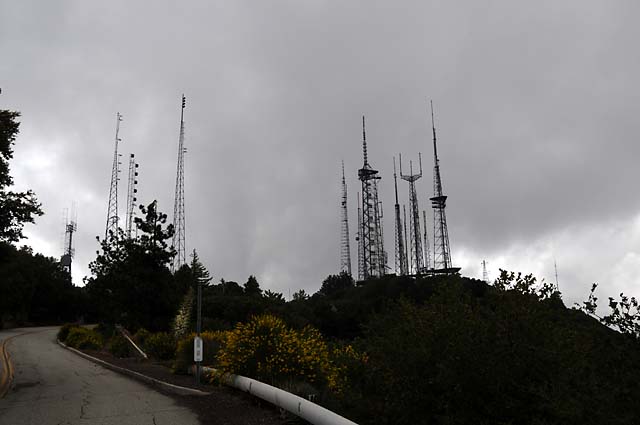
Look at all those antennas!
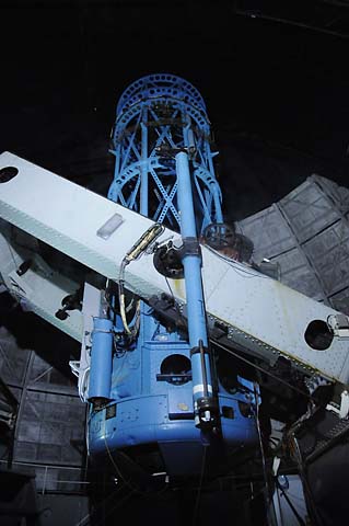
Here's the sleeping 100" telescope. The mirror is at the bottom, and is 100" across.
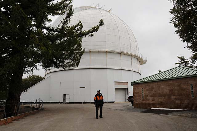
Dr Bob outside the 100" telescope observatory.
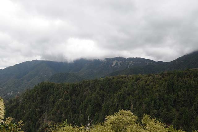
Here's how Mt. Wilson looked when I got back down to Angeles Crest Highway. Compare this with the picture five frames back. The top of Mt. Wilson and the antennas have disappeared.
This is Newcombs Ranch, a biker spot.
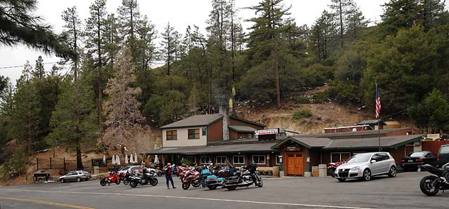
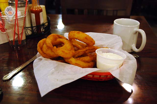
And this was my lunch. Hanna and I believe Newcmbs have the best onion rings we have ever tasted. They are not on the menu, you have to ask for them.
After lunch, I hustled to get back down the mountains before I got hit with rain or snow. It was cold up there, below 40°F.
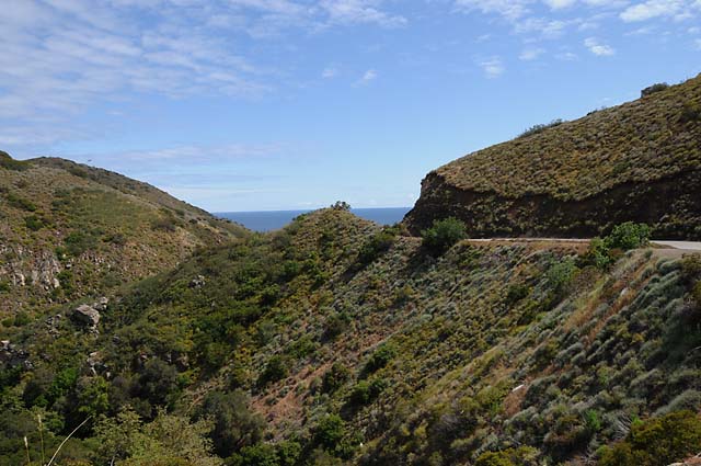
Quite a contrast now, I am on Mulholland Highway, closer to the ocean, and the threatning clouds are elsewhere. Mulholland Highway runs west from Topanga Canyon to the Pacific.
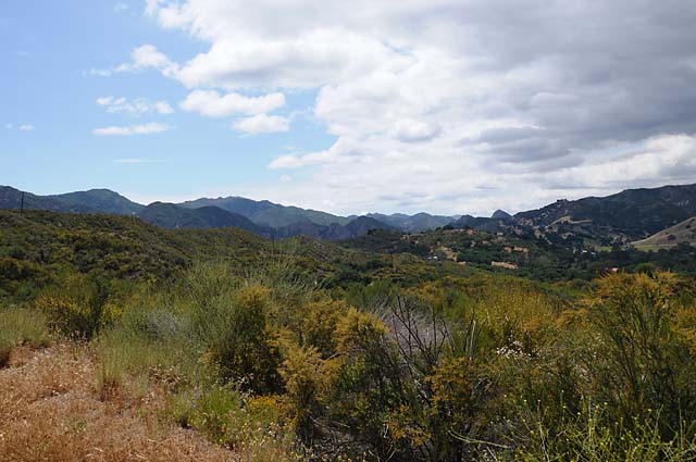
I love this spot. If I had a horse ranch, here's exactly where I would want it to be.
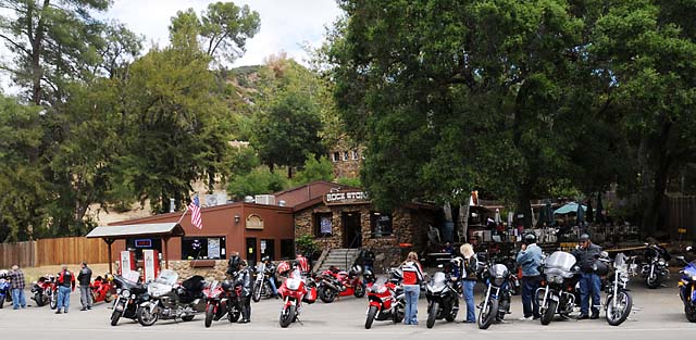
I stopped at the Rock Store, another biker spot.
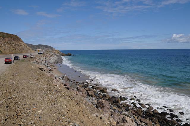
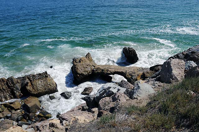
As you ride along Mulholland Highway, you get occasional peeks of the Pacific. Here, I am descending, and get a really great view of the ocean.
The Pacific.
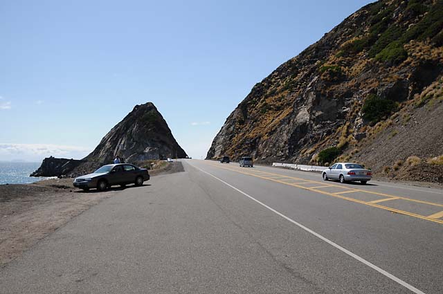
I'll bet you have seen this before, in TV commercials.
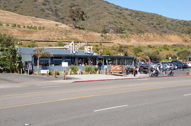
Neptune's Net, another biker spot.
|
|
|