| Travelogue -- Dr Bob's Blue Ridge Motorcycle Ride |
| Send a message to Dr Bob |
|
|
|
|
January 2010
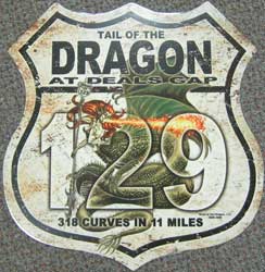
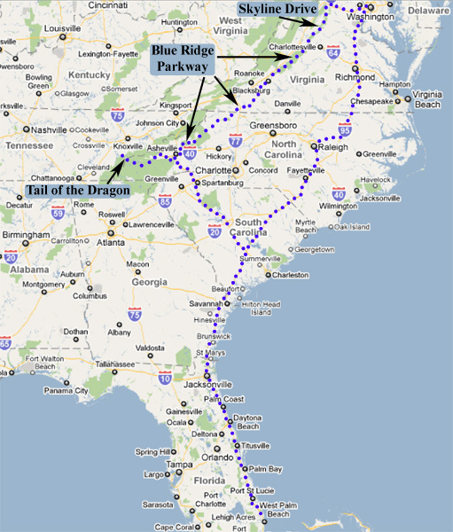
I am planning a ride during the spring of 2010, probably leaving home May 25. I will ride from Florida to Deals Gap, North Carolina to ride the Tail of the Dragon (318 curves in 11 miles), then the Blue Ridge Parkway, and then Skyline Drive. After a visit with my son and his family in Falls Church, Virginia, I will return to Florida. The ride will take ten to fifteen days and cover about 2,500 miles. I plan to take a photo of the capitols I pass, South Carolina, North Carolina and Virginia.
Here's the route I am planning.
24 March 2010
One of my first steps preparing for my Blue Ridge Ride was to have an oil and filter change on my bike. Also, I had noticed a minor oil leak on the garage floor. And, for the past week, the idle RPM has run up from 1200 to 1800 in three to four seconds, then suddenly down to 1200, and then it repeats the cycle on and on and on. The oil leak was simple, the shifter gasket needed to be replaced. It turns out that the idle problem was because of an induction manifold leak. I was told that the manifold leak caused the motor to speed up because the mixture was lean, then the motor rapidly heated sealing the leak, thus causing the idle to drop again. While I was at the Harley shop, I took the opportunity to price a new bike and get an appraisal on mine. I decided the difference was too much. No new bike for the Blue Ridge Ride!
25 March 2010
I went out to fire up the bike to run a couple of errands. It wouldn't crank. Uh-oh! Are the old wiring problems showing up again? I jiggled the bundle of wires where the problems had been in the past, and sure enough she started. (If you don't know about the wiring problems from my Route 66 Ride, see what I wrote on 09 April 08 and on 22 April 08 and especially on 08 May 08.)
That was the moment when I decided I could no longer trust my bike to take me on a long ride without problems.
I called the Harley shop and made a deal for a new bike.
31 March 2010
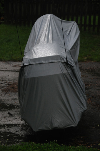
My new bike being delivered to me.
04 April 2010
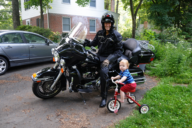
I did a long ride today, about 355 miles, to complete the break-in of my new bike. I rode it to Haines City to show it to Ralph and Lisa.
Then I headed to Lakeland to show it to Gisi. Then I headed to a Dairy Queen to have a chocolate shake!
29 April 2010
I did another ride today, about 155 miles, to get up to 1000 miles on my new bike. That's when the first oil change is due. The break-in oil will be drained, the oil filter will be changed, and I will use synthetic oil in the future. I found a Dairy Queen in Okeechobee, so I was able to have my chocolate shake. Just part of getting in shape for my ride.
My first service is scheduled for next Wednesday. I will have a super-loud horn installed. I learned years ago that a loud horn can be very important when somebody in a car tries to take my spot on the road. I want them to think I am an 18-wheeler.
5 May 2010
Had my 1000 mile service today. Got the super-loud horn installed.
25 May 2010, 10:00 AM, North Palm Beach, FL
My trip began today. I'm off to the Blue Ridge Parkway, and other delights. Hanna wished me a good trip.
I plan to ride US-1 all day. If it gets too slow and boring, I may divert to I-95. Check back later tonight or tomorrow morning for an update.
25 May 2010, 1:00 PM, Rockledge, FL
I am at a McDonald's having my first chocolate shake. They have WiFi, so I can update you on my progress. Cape Canaveral is just ahead.
25 May 2010, 8:00 PM, Brunswick, GA
Stopped for the night. Ran 373 miles today. I will give you pictures after I have dinner. I am at a Best Western, Hanna and I have stayed here several times. They have an Italian restaurant. That's were I am headed.
25 May 2010, 11:20 PM, Brunswick, GA
I was in showers on and off until I reached Rockledge. Maybe the chocolate shake somwhow counteracted the showers. The first shower was less than 10 miles from home. I don't mind the showers too much, though. It was pretty. During the first shower I was in 100% sunlight. My riding suit is also a rain suit. I don't have to stop and put on rain gear. I did not have this suit on the Route 66 Ride. I had to stop to put on raing gear, and the rain gear was HOT, then stop to take it off. This is much better. I have zippers that open and close vents. Really nice. Made by Tour Master.
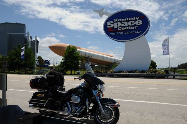
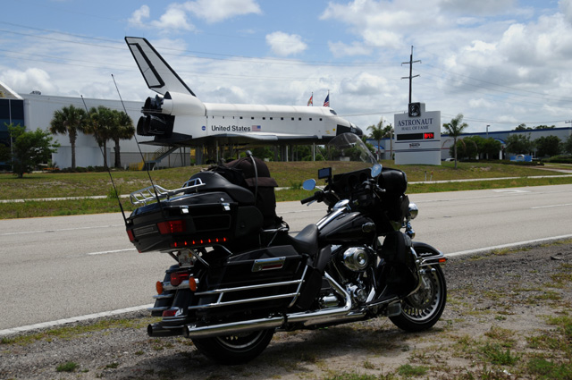
I did divert to the Kennedy Space Center. I decided not to pay $38 to go inside. I stopped on the road to get a couple of pictures. I think the first one is the booster rockets for the shuttle. The second one is a shuttle. I don't know if it is real or a mock-up.
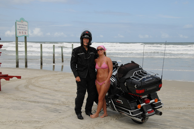
I did stay on US-1. After Cape Canaveral, I made a stop at Daytona Beach. I wanted to ride on the sand. That was both good and bad. The bad first. I got stuck in the sand. The good - I had help getting unstuck.
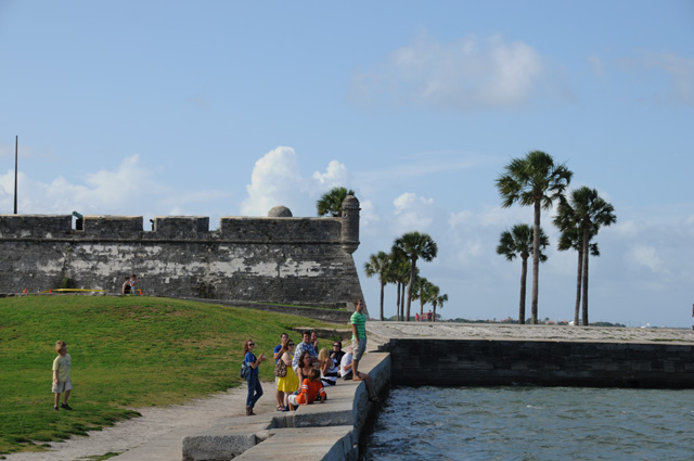
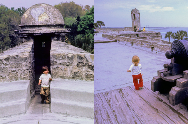
After getting unstuck, I headed north again on US-1. I wanted to get a picture of the old fort in St Augustine. Here's a shot of a corner of the fort, with one of those little towers. I remember the towers from 38 years ago, when Darryl and Cindy, my children, were little tots. First today's picture, then pictures from 1972.
From St Augustine, I continued north on US-1, all the way through Jacksonville. Sometimes it was hard to figure out where US-1 was. Then on the north side of Jacksonville, I got on US-17 and continued into Georgia. Then I got on I-95 to find the Best Western. It is not on US-17.
Tomorrow I will try to get back on US-17 to Savannah, then US-321 to Columbia.
Good night.
26 May 2010, 7:00 PM, Spartanburg, SC
Another 333 miles today, 706 total. At a Red Roof Inn. Pictures will come after dinner.
26 May 2010, 10:30 PM, Spartanburg, SC
I had no trouble this morning finding US-17. It was a very pleasant ride. It was two lanes. The speed limit is usually 55 mph, but down as low as 30 mph in numerous very small towns. I took it into Savannah. Leaving Savannah, I stayed on US-17 for a few miles, then got on US-321 where it started. It was a long haul into Columbia, about 130 miles, maybe more. There was very little traffic. Again, two lanes. Like US-17, the speed limit would drop as low as 30 mph in numerous small towns. After Columbia, I stayed on I-26 until I stopped for the night.
Lunch (aka Chocolate Shake) was delayed because there were no Dairy Queens or McDonalds or Wendy's, etc. on US-321 until I got to the suburbs of Columbia. The first thing I found was a McDonalds. They had wi-fi, but apparently it wasn't working, so I did not get on the Internet until I arrived at my stop for the night. But I did have my chocolate shake. That works well for my lunch. I don't get that sleepy feeling that often comes if I eat a real meal. And, it lasts until dinner time.
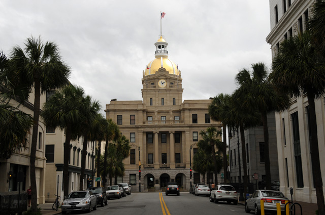
Now for some pictures. City Hall in Savannah caught my eye. I had to circle around to find a place to get this picture.
And this bridge caught my eye. I kept riding around until I found a good place to take the picture.
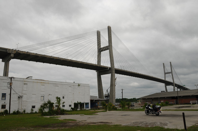
It turns out that the bridge is US-17 heading north out of Savannah. I didn't know that when I took the picture. I only learned that as I left Savannah by climbing the bridge!
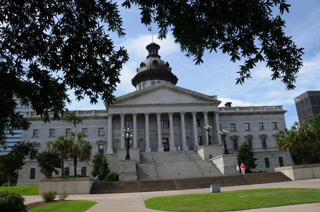
Now for my picture of the South Carolina State Capitol in Columbia. The first picture below is the one I wanted to match, taken by my father in 1953. That's me in the yellow T-shirt to the right of the steps. The second picture is mine from today. Again, that's me, but not in a yellow T-shirt. This time I am wearing black. Also, I am in a different position because there are new steps that block the view, and there are trees that were not there in 1953.
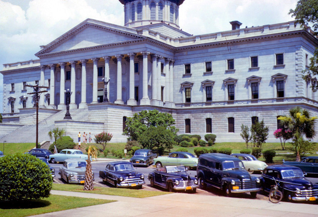
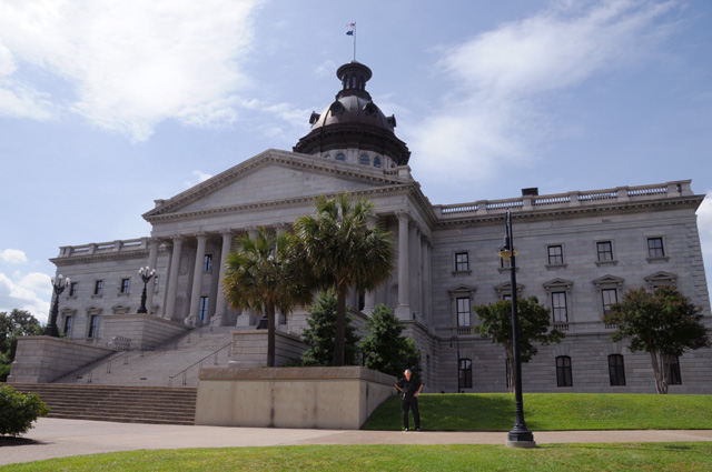
I couldn't exactly match the picture because today there are those extra steps with a very large pedestal at each end in front of the Capitol steps. Also, the ground goes lower today, so the perspective is different. My father's picture was taken from a higher position.
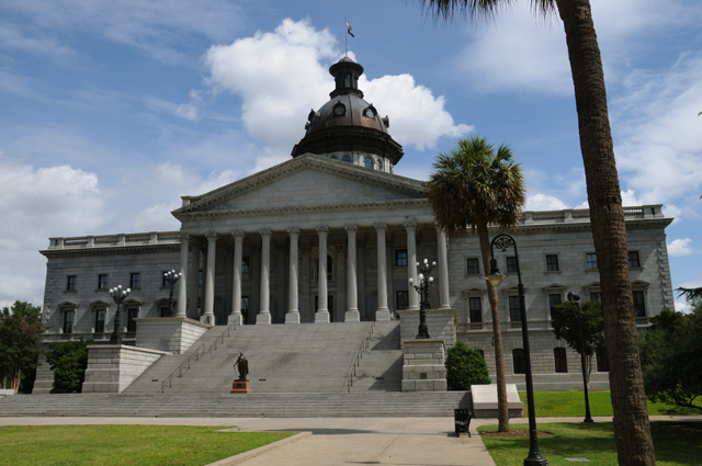
Those two pictures are the front view of the Capitol. (I was told that this is the front, although I have found information on the Internet that says the front is where the statue of Washington is!) The two pictures following are the front view straight on, and the rear view straight on. Very similar. You can tell which view my father took. Note the black thing sticking up on the roof on the right that you see only from the front side (the trees block your seeing that it is not there on the rear side in the picture I am showing here, but trust me, the black thing was not there). Note also there is a statue of Washington in the middle of the steps on the back side. That statue was there during the Civil War, so it would have been there in 1953. And, the stairs are wider on the rear, they span 6 of the 10 columns on the back, they only span 4 of the 10 columns on the front. I had to get my computer off the bike to figure this out while I was at the Capitol to make sure I was getting my picture on the proper side.
That's it for today. More tomorrow.
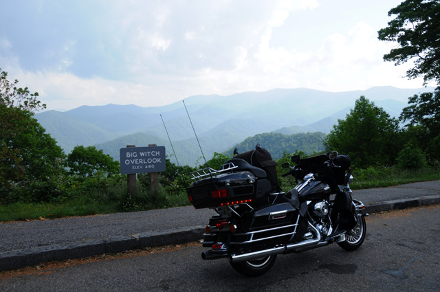
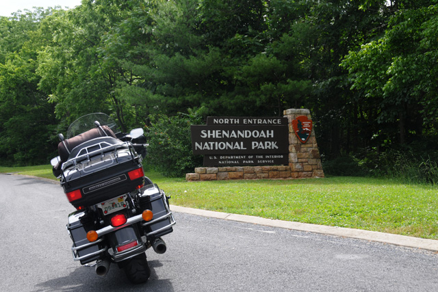
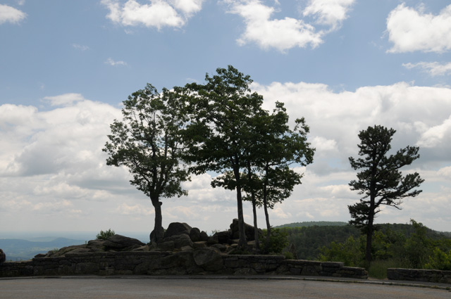
27 May 2010, 8:00 PM, Cherokee, NC
Today I did 366 miles (1069 total). I rode the Tail of the Dragon and the Cherohala Skyway. More after dinner.
27 May 2010, 10:30 PM, Cherokee, NC
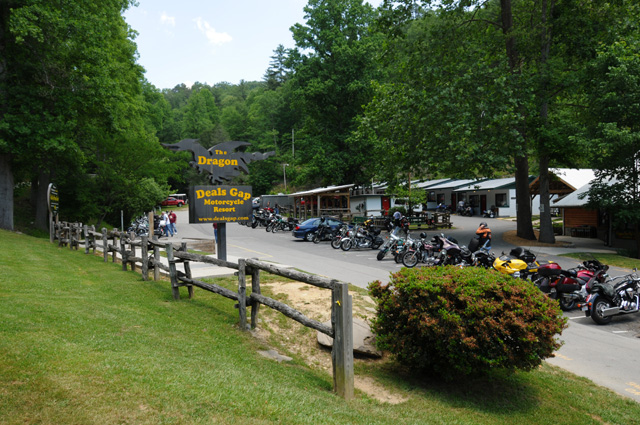
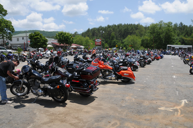
Leaving Spartanburg, I stayed on Interstates until they ran out. Then I was on US-74 till I turned off that onto a NC state road. That road had many curves and switchbacks. After a while I arrived at Deals Gap and had lunch. No chocolate shake today. They didn't have any. I had to suffer.
After lunch I ran the 11 miles of the Dragon. Because of a rock slide, the road was closed after the end of the Dragon, so I turned around and ran it the other way. I had planned to do a big circle of the Dragon and the Cherohala Skyway, but that was not possible. So, I then headed a bit south to do the Cherohala, then turned around and did it the other way. Then to Cherokee.
The Dragon has 318 curves in 11 miles. On average, there are 10 city blocks per mile. 11 miles would be 110 blocks. That means 3 curves per block! The only time the bike was straight up, rather than leaned left or right, was when I was going through the upright to lean in the other direction!
There are people along the Dragon who take pictures of all the bikes coming along and post the picture on the Internet. Then you can find yourself and buy the pictures. I will look them over and buy whatever looks good and post it on this page. The space immediately below will hold them. Whatever day they are posted, I will put a note in my log for that day with a link back to this spot.
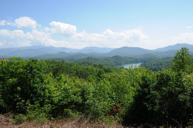
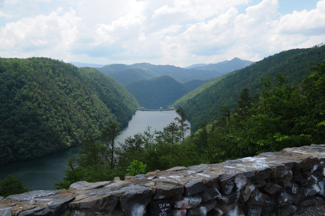
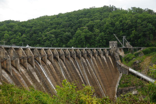
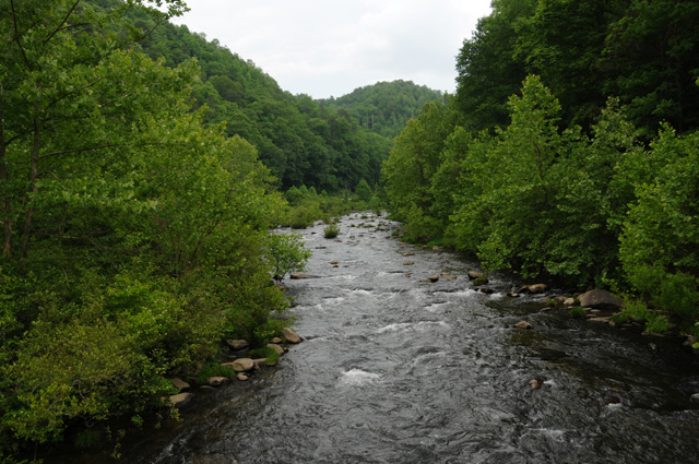
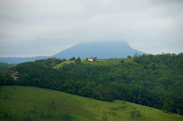
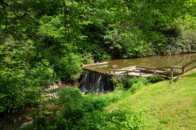
I don't have a lot of pictures to share today. They are pictures taken in the mountains. There's a bunch of bikes at Deals Gap, a lake and mountains, a lake with a dam and mountains, the dam, and a babbling brook.
Now I will imagine the sounds of the babbling brook and slowly go to sleep.
28 May 2010, 3:00 PM, Asheville (West), NC
Lunch time. Chocolate shake. McDonalds. With wi-fi. More later.
28 May 2010, 6:30 PM, Asheville (East), NC
I now have 1216 miles total, 147 today. That's not that many. It was all on the Blue Ridge Parkway, or excursions off the Parkway (including the Vanderbilt Mansion which I will tell you about later). I have gone 84 miles up the Parkway. There is a portion of the Parkway that is closed because of a rock slide. Three miles are closed, I went all the way to the blockades on each side, meaning some backtracking. I could not see the rock slide.
I quit earlier today. I stopped at the Parkway headquarters on the east side of Asheville. I was told that the next exit north where I could find lodging would be at least a couple of hours, and I didn't want to ride that much more, so I quit.
There have been thunderstorms today, in fact, I just heard a loud crack of thunder. I rode in a thunderstorm this morning. There may have been some small hail. If not, it was big raindrops. I could hear them banging down on my helmet. Made me think I was in a tin roof barn in driving rain!
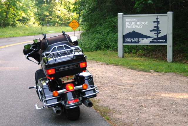
As I have been on the Parkway now, I can officially claim this as my "Blue Ridge Ride"!
More after dinner.
28 May 2010, 9:50 PM, Asheville (East), NC
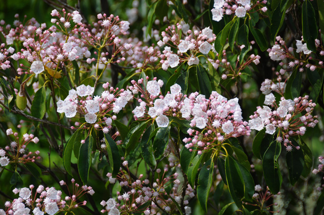
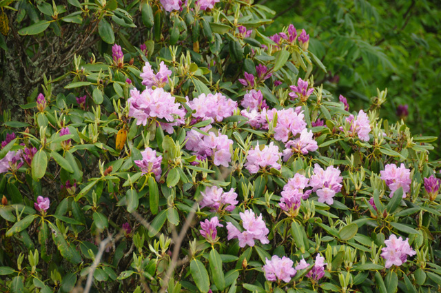
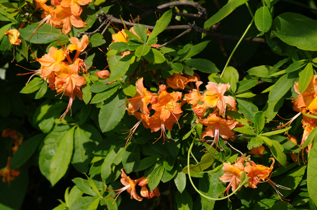
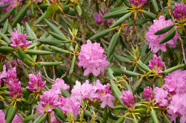
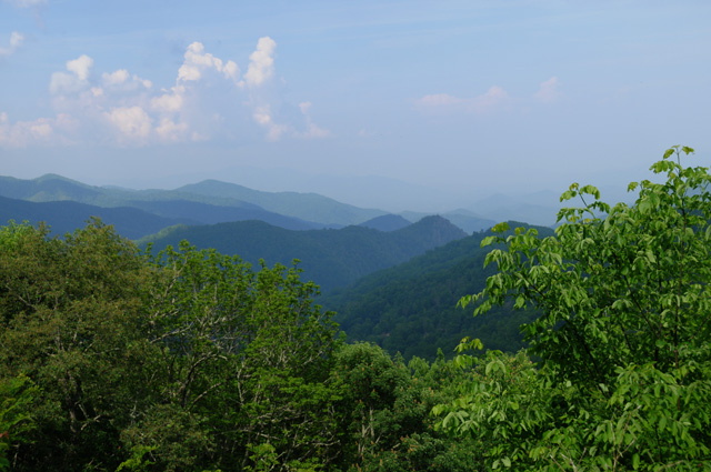
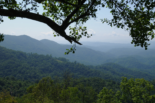
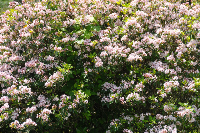
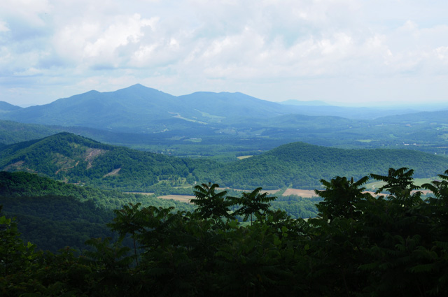
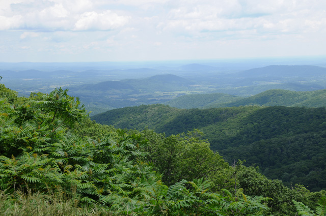
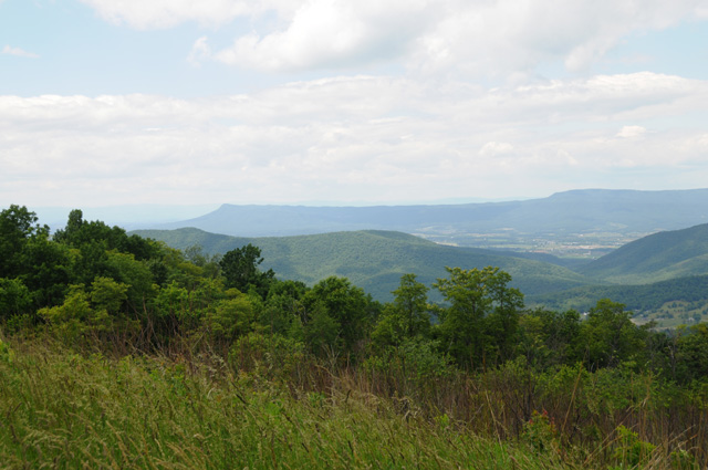
Today I took some more mountain pictures. I won't put many up, though, because it seems that once you have seen one you have seen them all. I took some flower pictures. That's what I am going to give you now.
The thunderstorm that pelted me is just ahead.
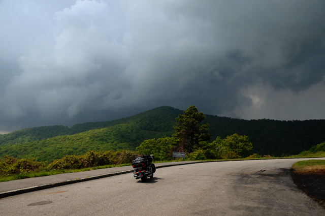
Now it is behind. Maybe the high elevation was a factor.
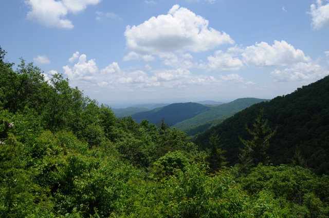
Now for my mountain pictures.
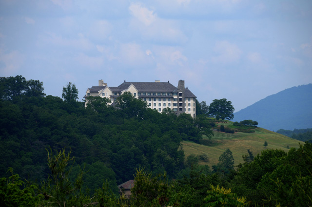
And finally, the rest of the Biltmore Mansion story. Hanna and her Berlin Lady Friends were planning to spend a few days in Asheville touring the Biltmore estate shortly after I get back home. Turns out they had to cancel the trip. So, I wanted to get a picture of the Mansion "for Hanna". I rode to the estate. Once I entered the property, I must have ridden half a mile to a mile when I came to a guard shack. I waited in line and then told the guy I only wanted to get a picture of the Mansion for my wife, she had to cancel her trip in two weeks. He said he couldn't let me in, and that I was still four miles from the Mansion. He suggested I go to the visitor center. I did and told my story again. I was told that I would have to buy a ticket to see the Mansion even from outside, that it cannot be seen from any of the roads around. I decided to not pay to get the picture. I headed back into town and at a high spot, I was able to see the Biltmore Inn (not the Mansion) because it sits on a hill (the Mansion is in the valley). So, here's my Biltmore picture. It was quite some distance away and this is with a long telephoto.
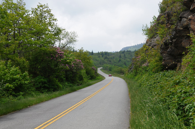
My last picture tonight is a section of the Blue Ridge Parkway. I took the picture looking back where I had just come from. I thought this was a most beautiful little stretch of road.
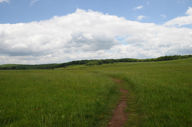
29 May 2010, 5:45 PM, Boone, NC
I quit early again today. No rain or thunderstorms, although they had been predicted. I was a little tired, so I decided to call it a day. I now have 1350 total miles, 134 today. I picked up another 90 miles on the Parkway.
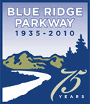
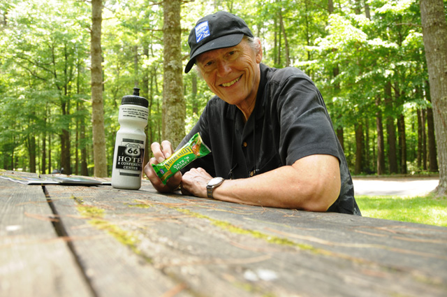
No chocolate shake for lunch today, I don't think they serve them on the Parkway. I had lunch at a picnic table along the Parkway. I had packed my lunch ahead of time. A power bar and water. Actually, two power bars. The second one is under the camera to make the lens point up into my face. The water is in my Route 66 biker's mug. It fits in a leather bag on the side of my bike so I can grab a sip any time I want to. I am wearing my 75th Anniversary Blue Ridge Parkway cap. If you check my Intro page, you can see the logo that's on the cap.
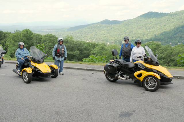
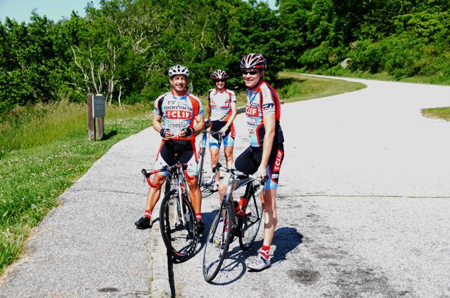
The first picture I took today was two bikes with their owners and spouses. They are from Greenwood, Indiana. This is the first time I have seen one of these bikes up close.
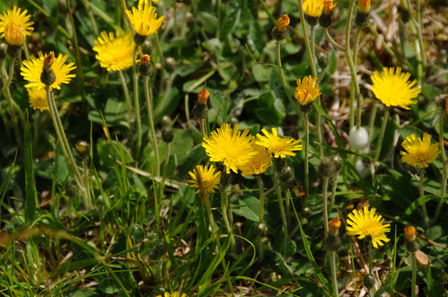
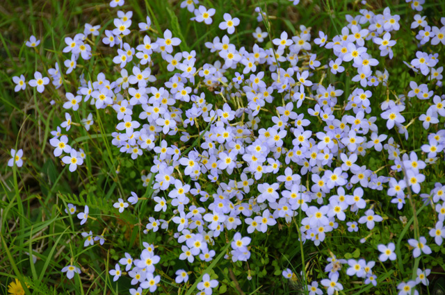
Only one flower picture today.
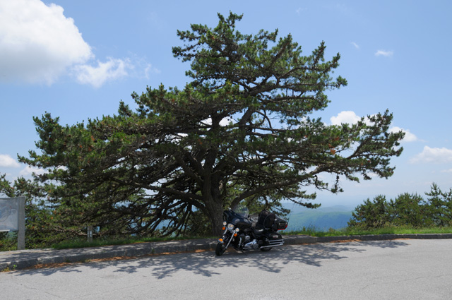
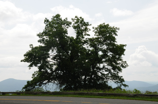
I liked the looks of this tree.
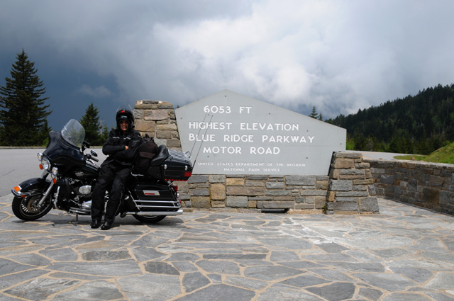
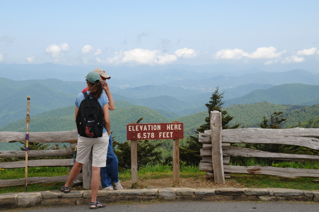
I rode to the top (almost) of Mount Mitchell. Its peak, at 6684 feet, is the highest point east of the Mississippi River.
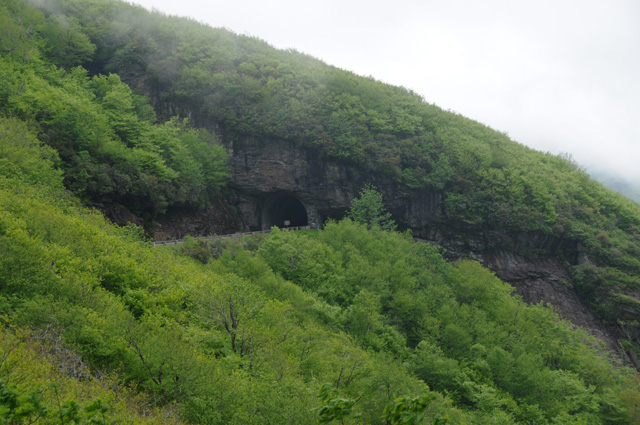
One of the many tunnels along the Parkway. You can see how the top of this mountain is in the clouds.
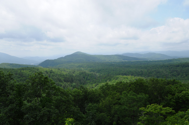
That's it for today. Not a lot of pictures. Wait a minute, I didn't give you a real mountain picture. As I have said, see one you have seen them all. Well, here's the one.
30 May 2010, 6:00 PM, Hillsville, VA
I now have 1482 total miles, 132 today, about 90 of them on the Parkway. I am at mile marker 200, Cherokee was 469. I have another 200 to go on the Blue Ridge Parkway before reaching the Skyline Drive. I had a little rain, not too bad.
My first picture today is going to be a little different, I am going to show you another style of biker. I must apologize to the three bikers, I made a big error taking the picture. The highlights are blown out. I forgot to reset the camera from my last picture yesterday when I needed to lift a dark picture. I don't do this often, and did not notice the error until a few miles down the road. The picture was taken in sunlight, so I didn't notice that the image was overexposed. Sorry guys. Some of my readers may not realize what's wrong, but the bikers will, their blue shirts look white! They weren't white, they were blue.
Lunch was just off the Parkway, at a bike resort, or so it was billed. There were a few bikers there. Again, no chocolate shake. Poor me.
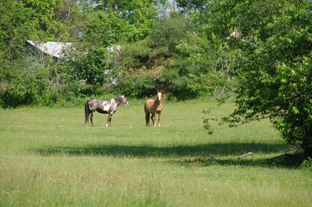
Today a new category of picture, a living horse, not the iron version.
My first of two mountain pictures for today.
This one is in the neat looking tree category.
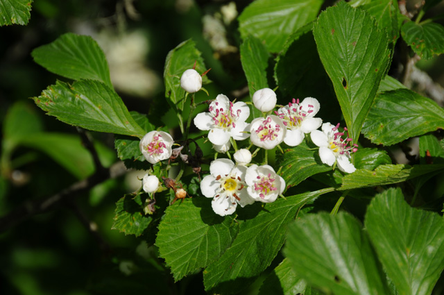
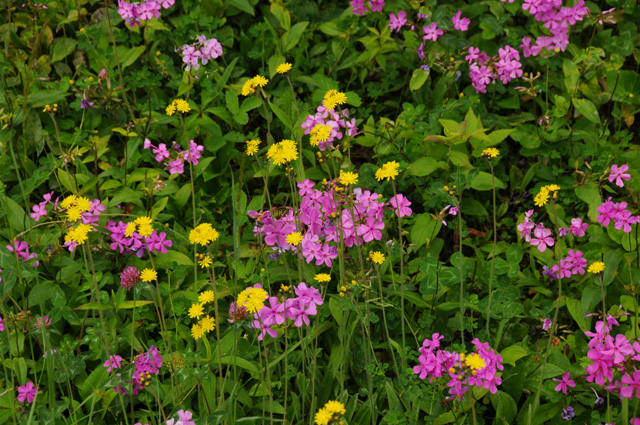
And now for the flower category.
The pleasant road category.
My second mountain picture.
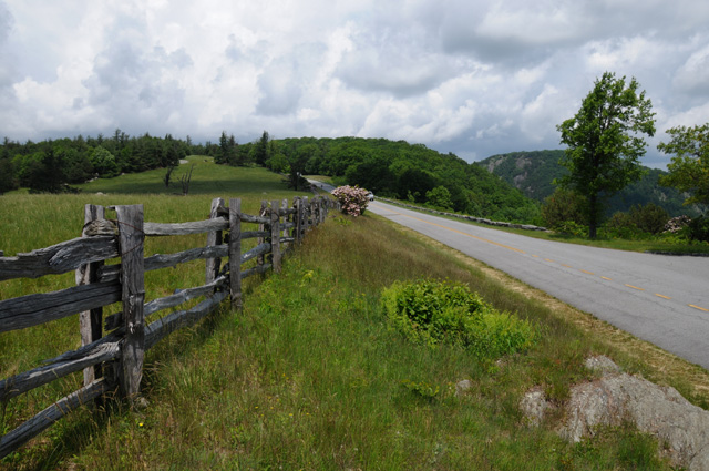
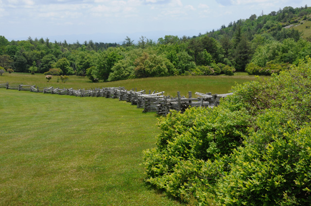
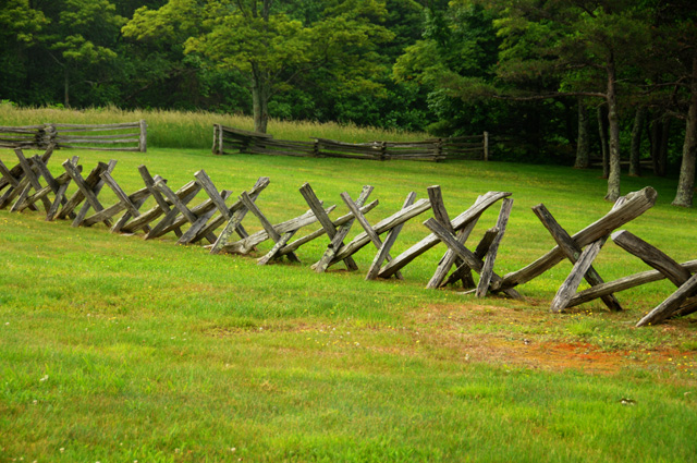
The first entry in the fence category (maybe you can count my pleasant road picture as a fence picture).
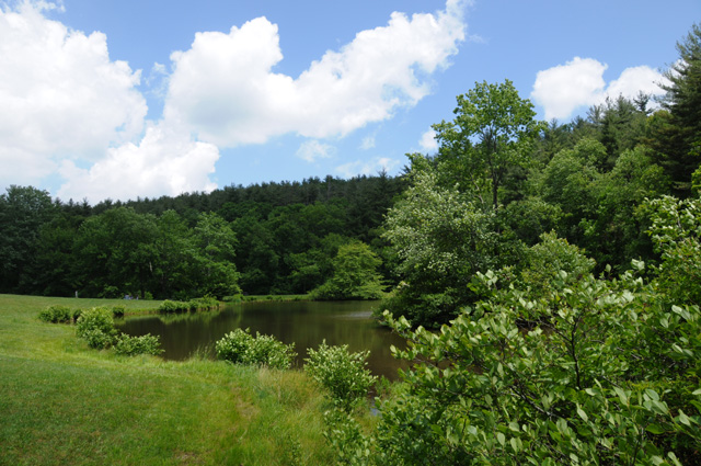
Another new category, the pond picture.
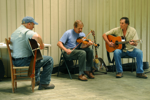
And my last picture for today is from the Blue Ridge Music Center. I enjoyed their music for almost an hour, then headed out to get a room for the night.
See you tomorrow!
31 May 2010, 4:30 PM, Roanoke, VA
Another short day. 1591 total miles, 109 today. I am at mile marker 112 on the Parkway. My ride ended in a thunderstorm. I went to a Best Western, but they would not let me leave the bike under their portico overnight, so I left. The Comfort Inn next door would let me park under their portico, so I stayed!
Not a lot of pictures.
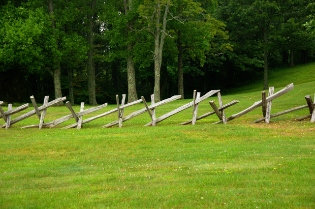
This is a "buck rail" fence.
This is Buffalo Mountain, so named because it looks like a buffalo hump. You can see the top is in the clouds. It was like that for my entire ride today.
A little dam.
These mountains are called the Devils Backbone.
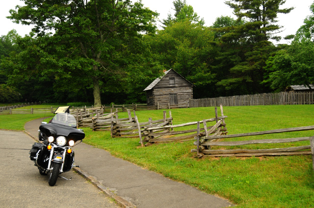
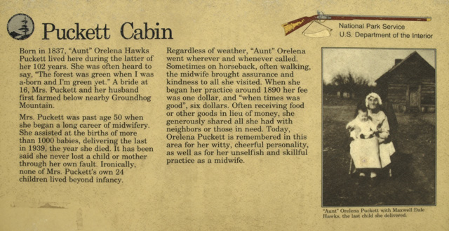
This was Aunt Puckett's cabin. Read her story below. Twenty-four children of her own, and none survived infancy!
1 June 2010, 7:15 PM, Waynesboro, VA
Stay tuned for pictures and text after dinner.
1 June 2010, 10:20 PM, Waynesboro, VA
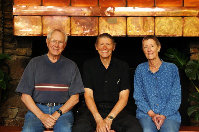
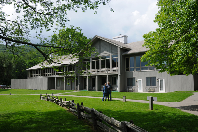
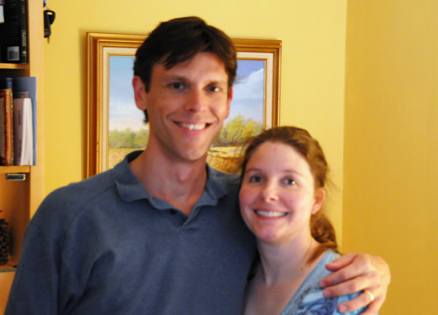
I met Dick and Pat West for lunch at the Peaks of Otter Lodge and Restaurant on the Blue Ridge Parkway. I first met Dick when we worked at RCA in Camden, New Jersey many years ago, probably in 1975. Our paths crossed again at Sony Pictures in Los Angeles in the second half of the 1990s. I don't think we have seen each other for more than ten years. We had a delightful lunch and did our best to catch up on what is happening in each others lives.
Before lunch, we had covered the bike because it looked like it would start raining at any minute. Indeed, we were just barely inside the restaurant when it started raining. Then, as we were parting after lunch, we could see that the sky to the north was rather dark. Just where I was headed.
At the lodge I did not have cell phone service, and I did need to talk to Hanna. About ten minutes after leaving the Lodge, I stopped at an overlook point and discovered that I had cell service there, so I made a quick call. I knew the rain was on its way. I made a second equally quick call, but before I finished it, the rain started. I wanted to get on the bike. I prefer riding in the rain to simply sitting in the rain! It lasted a few miles, then slowly it got sunny and stayed that way the rest of the day. Two days in a row now I have ridden through a thunderstorm.
I finished the Blue Ridge Parkway. Tomorrow I will start the Skyline Drive. With today's pictures, I will sort of wrap up on the Blue Ridge. To begin, I must give you a flower picture and a tree picture.
I felt it necessary to point out which was which in case you couldn't figure it out yourself.
I thought this sign was interesting enough to show it to you.
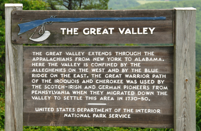
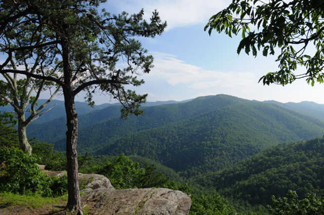
And here's a picture of the Great Valley.

I don't think you can see much, it looked better in real life, you should have been there with me. Anyway, you can see there is another ridge in the distance and a large valley between the ridges.
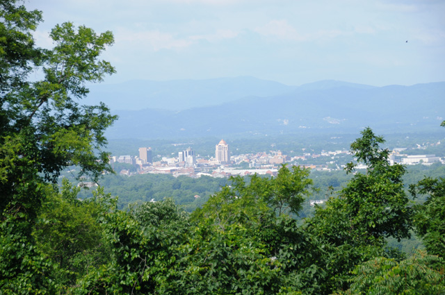
Here's a picture of Roanoke from the Blue Ridge Parkway.
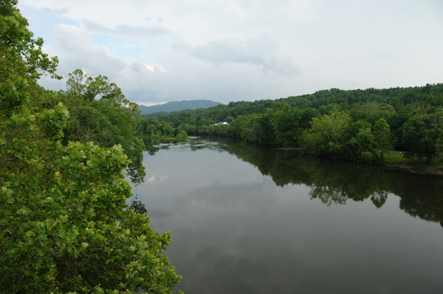
This is the James River. (A message for Dick: No shakes at Otter Creek!)
(Another message for Dick: I did not stop at Thunder Gap, it was pouring rain.)
Here's today's mountain picture.
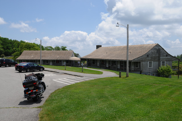
I spotted three lodges along the Parkway, and I stopped at all three.
Toward the south end is Pisgah Inn.
About the middle is Bluffs Lodge.
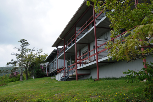
And toward the north end is Peaks of Otter Lodge. That's Dick and Pat in front of the Lodge.
There are cabins at Rocky Knob, but I missed them.
I considered spending a night at Peaks of Otter Lodge, but decided not to because there is no Internet service. I couldn't bear not getting on the Internet for an evening. What would you do if you couldn't look at my pictures? I didn't want to do that to you.
2 June 2010, 8:30 PM, Falls Church, VA
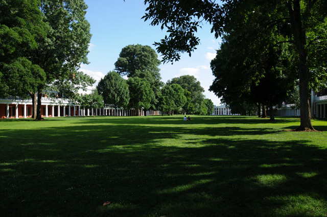
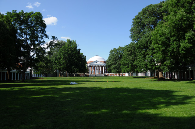
I now have 1862 total miles on this ride, 138 today, and 133 yesterday (which I forgot to mention). This morning I went to Charlottesville, where the University of Virginia is located, because I wanted to get a picture of "The Lawn". My son Darryl is a graduate of UVA, so I was going to take the picture for him and include it on my travelogue. But, I was so tired I didn't even park the bike to get a picture, I just kept going. I did not start Skyline Drive. I went straight to my son's home in Falls Church, Virginia, to get some R&R. When I leave here, I may return to Skyline Drive, but we'll see when the time comes.
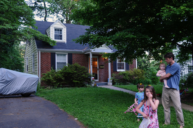
Here's Darryl and his wife Susannah.
They have three wonderful children, Sophie, Nick, and Sam.
After I spend a few days here, I will be ready to roll again.
3 June 2010, 6:00 PM, Falls Church, VA
No miles today. Took it easy all day long. Read some of "Presumed Innocent" by Scott Turow. I have never read the book, and he has just released "Innocent". So, I got a paperback copy of the 1987 book to read during downtime on my ride. I also got a hardback of the new book to read when I get home.
This afternoon it rained on the Skyline Drive, and it is raining here now. If I had stuck with my previous plan to do the Skyline Drive yesterday and today, I would have had lots of rain today, probably arriving here in the rain. So, I said to myself, what should I do about pictures today? I think this one picture sort of sums it up well.
4 June 2010, 7:15 PM, Falls Church, VA
No miles today. On Saturday or Sunday, I will ride around Washington, DC to get some pictures. I expect to head out of here Monday morning to hit the Skyline Drive.
5 June 2010, 5:45 PM, Falls Church, VA
Sam and I are ready to roll to the US Capitol for another Kodak moment.
Here's the Capitol. Not sure where Sam is, I guess he took a wrong turn somewhere along the way. I am sure he will be home when I get back.
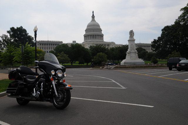
Getting to the Capitol was not easy. I crossed the Theodore Roosevelt Bridge expecting to ride along Constitution, but it was blocked. I headed up town on 23rd past the Department of State, and then turned east on F Street. I couldn't get to Constitution on 18th. I continued and had to go north on 17th when I reached the White House. I turned east on H Street. I couldn't get to Constitution on 14th. Finally on 9th I could get down to Constitution, but one block later I had to go north because Constitution was blocked again. Then just a couple of blocks west of the Capitol, I could get back on Constitution. I took 1st Street NW in front of the Capitol, parked the bike, and got my picture.
Then I headed up North Capitol Street, past the US Soldiers and Airmens Home where my Aunt Nettie lived, into Maryland, and on up to the Beltway. Then I headed back to Falls Church on the Beltway. I picked up 46 miles today, and I have 1,908 total on this ride.
6 June 2010, 3:15 PM, Falls Church, VA
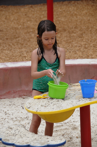
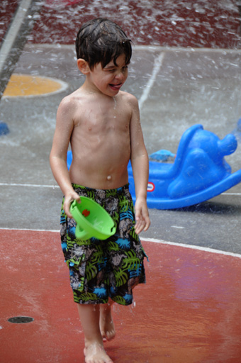
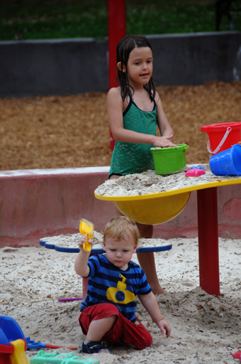
We had a picnic lunch today. The kids ate a little and played in sand and water a lot. The adults ate a lot and played in sand and water not.
Tonight the adults are going out to dinner while a sitter watches the kids. I plan to head out to Skyline Drive tomorrow morning.
7 June 2010, 8:50 PM, Charlottesville, VA
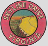
On the road again. I did 224 miles today, 2132 miles total. I headed out on I-66 to Front Royal, then south on Skyline Drive. I stopped to take a picture of the sign, which is just below. When I was ready to leave, I couldn't lift the bike off the kickstand. I had to ask some people in a car to help me lift it. That is embarrassing.
You may notice that the bike is leaning a lot to the left. The road was sloping up to the right, plus the kickstand dug into the soft asphalt. Nonetheless, I simply couldn't lift the bike off the kickstand. I was a little concerned when I parked the bike, because of the extra leaning, but I figured I could lift it when I was ready to go. I couldn't. Or, at least I did not think I could lift it without hurting my back. I have not mentioned it on this travelogue, but my back has been giving me trouble since last Tuesday afternoon. I started taking a heavy dose of Motrin (actually Advil but I always call it Motrin) Tuesday afternoon. That's the primary reason I decided to do some R&R at my son Darryl's home rather than go straight from the Blue Ridge Parkway to the Skyline Drive. I started cutting the dose Saturday night so that I am now taking one Advil three times a day. That's enough to mostly suppress the back pain that is left while not leaving me light-headed. (I took three Advils every day during my Route 66 ride, I had no back problems, I did that as a preemptive measure.)
I stopped at fewer overlooks today because I didn't want to be getting on and off the bike and endlessly lifting it off the kickstand. I do have some mountain pictures for you, they follow.
Today's tree picture.
This is Big Meadows.
I did the entire Skyline Drive, 105 miles. Then I headed east to Charlottesville to get a picture for Darryl. He is a graduate of UVA. I thought it would be nice to let him see the Lawn again, he hasn't been there for a while. Here are two shots, in opposite directions. The last time I was here I saw Virginia Governor Doug Wilder give the address at Darryl's graduation.
I was sad leaving Falls Church this morning. I am always sad when I leave there.
My consolation prize was a chocolate shake for lunch.
8 June 2010, 12:50 PM, South Hill, VA
What disappointment. At a McDonalds, their milkshake machine is not working. Oh dear, I guess I will try somewhere else.
8 June 2010, 5:45 PM, Fayetteville, NC
I am at a Comfort Inn in Fayetteville. I rode 295 miles today and now have 2427 total miles. A special thanks to Wendy's, their milkshake machine was working, had a chocolate shake. Got pictures of the VA Capitol and the NC Capitol. I will show them to you after dinner. There is a Cracker Barrel next door. Guess who's going to dinner.
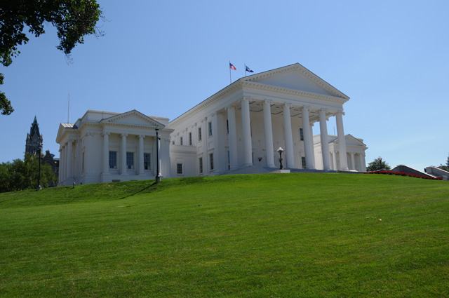
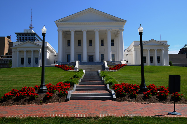
8 June 2010, 9:20 PM, Fayetteville, NC
Two views of the Virginia Capitol in Richmond.
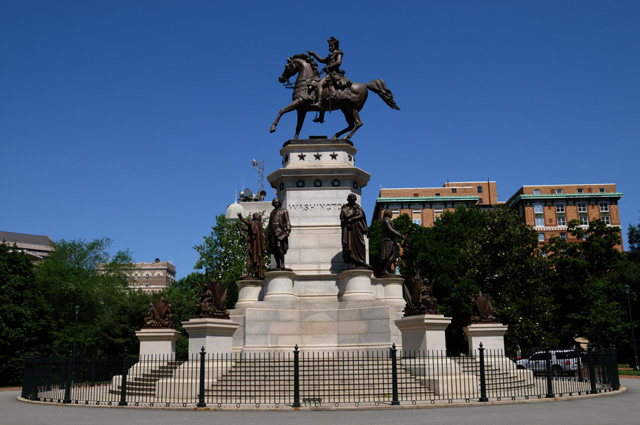
These two statues are on the Virginia Capitol grounds. This is George Washington.
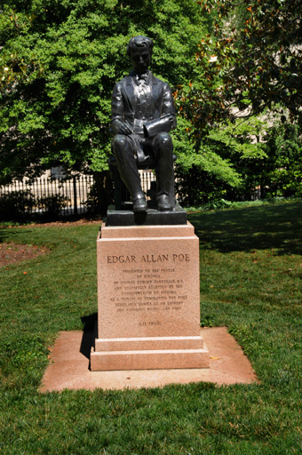
And this is Edgar Allan Poe. It made me remember something Darryl wrote in high school, 24 years ago, that he titled "Poetic Justice".
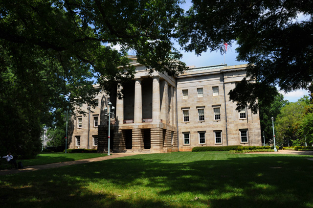
North Carolina Capitol in Raleigh. I was told that this is the front of the Capitol. The statue honors North Carolina men and women who served in America's wars.
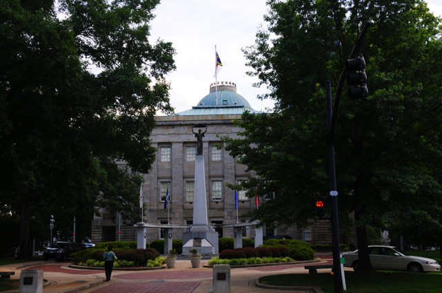
A side view of the North Carolina Capitol.
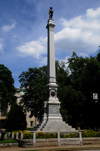
These two statues are on the North Carolina Capitol grounds. This statue reads, "TO OUR CONFEDERATE DEAD".
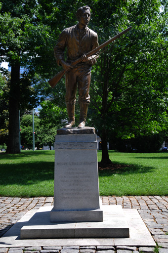
This is Private Henry Lawson Wyatt, the "FIRST CONFEDERATE SOLDIER TO FALL IN BATTLE IN THE WAR BETWEEN THE STATES".
That's all for today. I am headed home, I probably have two more days of riding ahead of me.
9 June 2010, 1:10 PM, Walterboro, SC
I have a proof photo from the Tail of the Dragon, click here to see it.
I am at a McDonalds having a chocolate shake in Walterboro. Hanna and I have spent the night here many times, it is the half-way point between North Palm Beach and Washington DC.
I have turned on my air conditioning. It is hot riding today. The temperature gage on the bike says it is over 90. There are no clouds, so the sun is constantly on me. What is my air conditioner you ask? It is a thing I tie around my neck that holds some special material that absorbs a lot of water. You soak it in water and it swells up big with all the water. The evaporation cools my neck which cools my entire body. I am soaking it again right now.
More later.
9 June 2010, 10:15 PM, St Augustine, FL
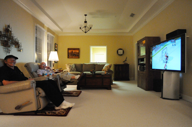
I had a longer day today, the most miles of any day, 435. I have 2862 total now. I did more miles because I wanted to get to Jim McKinney's home for the night. Jim and I were together at ATSC developing the HDTV broadcasting standard. Here we are watching the fruit of our labor in Jim's living room on Jim's HDTV set.
This is the first picture Jim and I have been in together since we were in Las Vegas in January 2009 to pick up the Emmy for developing the standard.
I have about 250 miles left to get home, and that should be tomorrow. Till then...
10 June 2010, 12:40 PM, Melbourne, FL
At a McDonalds. Having a chocolate shake. Bet you never would have guessed that!
About 100 miles from home. Will be there before too long.
10 June 2010, 5:45 PM, North Palm Beach, FL
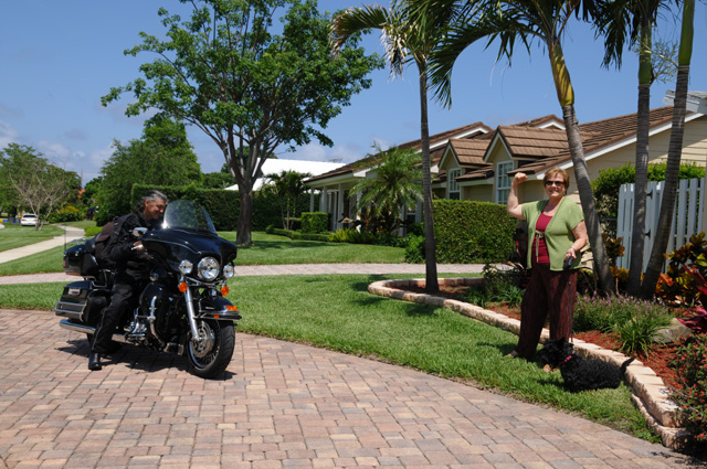
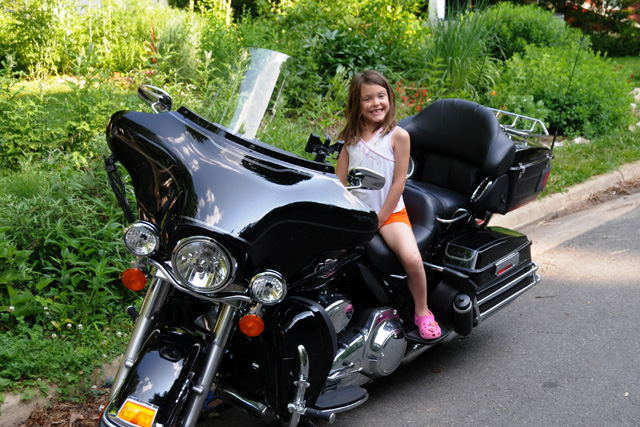
Hanna and Maggie were waiting for me when I got home. I was hot and tired.
This ride was harder on me than the Route 66 Ride. This ride was 1/3 the miles and 1/2 the days, but it was harder. Maybe it is because I am two years older. More likely it is the medication I am on. Getting old sucks.
Let me sum up this ride. I was on the road 17 days. I had 7 chocolate shakes, much less than one a day average. I'm slipping. I had 3140 total miles and used about 57 gallons of fuel, an average of 42 miles per gallon. I had zero bike problems. I was in seven states plus the District of Columbia (FL GA SC NC TN VA MD DC). My ride north was almost never on Interstates. My ride south was always on Interstates, except for the Skyline Drive. Going south I was tired and wanted the ride to be easier and faster.
This ride was intended to be spent in the mountains on twisty roads. It sure was that. It is a beautiful time of the year, everything was so green. There were flowers, but not as many as I expected, I was a little too late and missed most of the spring flowers. I was in lots of rain showers, especially the first week.
I saw Dick and Pat, long-time friends from my RCA days; and Jim from my ATSC days; and family, my son Darryl and his lovely wife Susannah and my wonderful grandchildren Sophie, Nick and Sam. I wanted to meet up with a friend from my Route 66 Ride, Bob McDonald, but we were unable to find a good time, we did talk on the phone several times. Maybe next time, Bob.
I may be tired, but I really enjoyed the ride.
However, I never saw the Raven. WHERE WAS THE RAVEN?