|
|
Travelogue -- Dr Bob's US Northeast Motorcycle Ride |
|
| Send a message to Dr Bob |
4 July 2014, 11:30 PM ET, Raleigh, NC
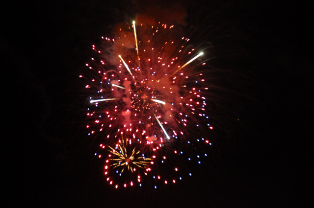
Let me start off with a loud sound, fireworks. Today is the American Independence Day. Those firworks are not from tonight, they are from one year ago when I celebrated the holiday with my niece and her family in West Lafayette, Indiana, at Purdue University (my alma mater), (Hail Purdue!), on my US Northwest Ride.
Today I want to talk about highway signs, or the lack thereof. As you know, I am trying to ride a specific highway on this ride, US1, or Highway 1, or Route 1. It runs from Key West, Florida to Fork Kent, Maine. I am not starting from Key West, but from my home town of North Palm Beach, Florida.
I have done other rides where I want to follow a specific highway, Route 66 and US50.
It is hard to do. Route 66 is by far the hardest, it was decomissioned some time ago, so there is no longer a Route 66. That means that the highway is normally not marked. You have to know where it is, or what the individual pieces are called today. That's why I will always recommend that you pick up maps especially for Route 66. They tell you where the highway is and what it is called today.
A GPS, as far as I know, cannot help you. They will guide you very well (most of the time, at least), but they cannot help you stay on a specific highway. The GPS will take you the shortest way, or the fastest way, etc., but not on a specific highway that you select.
Right now I am trying to follow US1. Sometines there is a US1 sign after an intersection, sometimes there is not. Sometimes you can go a few miles with no sign. Then you start wondering if US1 turned off somewhere, and you missed the sign, or maybe there was no sign.
I have a smartphone. It comes in very handy in this case. If I am unsure if I am still on US1, I simply pull over, grab my smartphone, go to Google Maps, and see where I am and if it is US1. If it is not, I can see what I have to do. If it is US1, I climb back on and continue. My GPS cannot do that, or at least, if it can it is hard for me to figure it out.
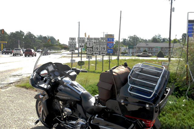
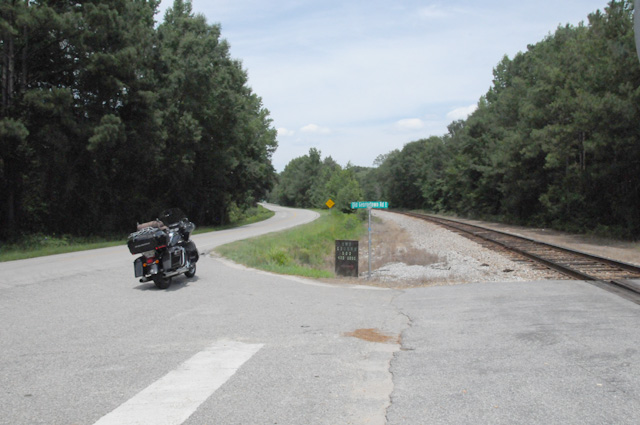
Ok, where am I headed with this? This morning I was running along in a 45 mph zone and blew through the intersection shown below. So, am I still on US1 or not? The anwer is yes, I am, but do you see the sign showing US1 turning left? There are so many signs here it is hard to understand quickly as you are flying by. It is the truck route that turns left, not the actual US1. Because I was not sure what the sign said, and because there was no US1 sign after the intersection, I stopped to find out the real story. My smartphone with Google Maps told me I was OK, but I decided to go back and get a picture and share this story with you.
Here's what I am saying. Sometimes it is very hard to stay on a specific highway that runs a long distance. You can't count on the GPS, it might take you on a shortcut. But if I want to be on US1, I don't want to be on a shortcut that bypasses part of US1.
Also, if your want to do Route 66, you really have to get the maps.
I encountered a state capitol today. I was running north on US1, and suddenly on my right was a capitol building. Wow I said, I must stop and take a picture.
You probably know already that I have been taking pictures of state capitols.
This capitol is actually on US1, at least the back side of the capitol is. In the picture below, the road running left and right is US1. I happened to catch a motorcycle running north on US1 in this picture.
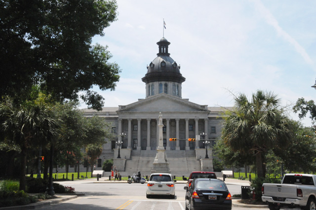
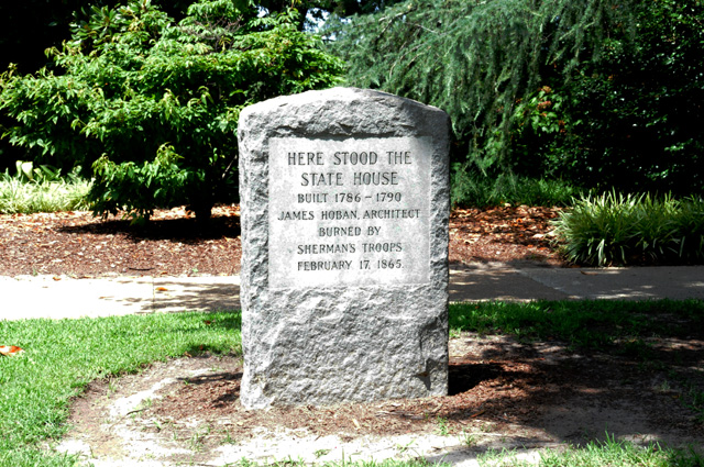
The capitol is South Carolina, Columbia South Carolina. Some of you may know that I have already taken a picture of the South Carolina State Capitol on a previous ride (Blue Ridge Ride in 2010). But my rules require me to take a new picture any time I go through a capitol city, even if I have already visited that city on my motorcycle. So, here we are. New pictures of the South Carolina State Capitol. This is the front.
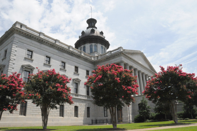
And this is a monument saying that there was another capitol building on this spot (just a few yards away from the current building) but it was destroyed in a war.
I had a lot more two-lane US1 today. It is really quite pleasant. In this case, there is a railroad beside US1. I have seen that many times the past couple of days, but this time I was able to get a good picture so I could show you.
One thing I remember from my Route 66 Ride is that there is virtually always a railroad beside the old Route 66. In fact, if you don't see a railroad, you have proably gotten off Route 66.
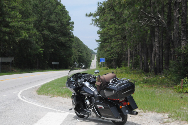
And my last picture for today, another shot of a two-lane portion of US1. It is hilly here, and a lot of curves. A pleasant ride.
Time to sign off. Tomorrow I hope to arrive in Falls Church where my son and his family live. I plan to spend two nights there, then off again on US1.
I rode 310 miles today, I now have 895 total. I counted ___ traffic lights today, now it is ___ total. I will start giving actual numbers in the next day or two. It is quite interesting. You must enter the contest now or you will miss out on the possibility of winning a chocolate shake.
While on that topic, let me tell you that it is very hard to remember time after time to push the button on the tally counter. You have to do it every time. And never twice. It is hard. Whoever came up with this crazy idea should have his head examined!
|
|
|